Lining Up Mystara III
Let’s tackle some of the easier issues this time.
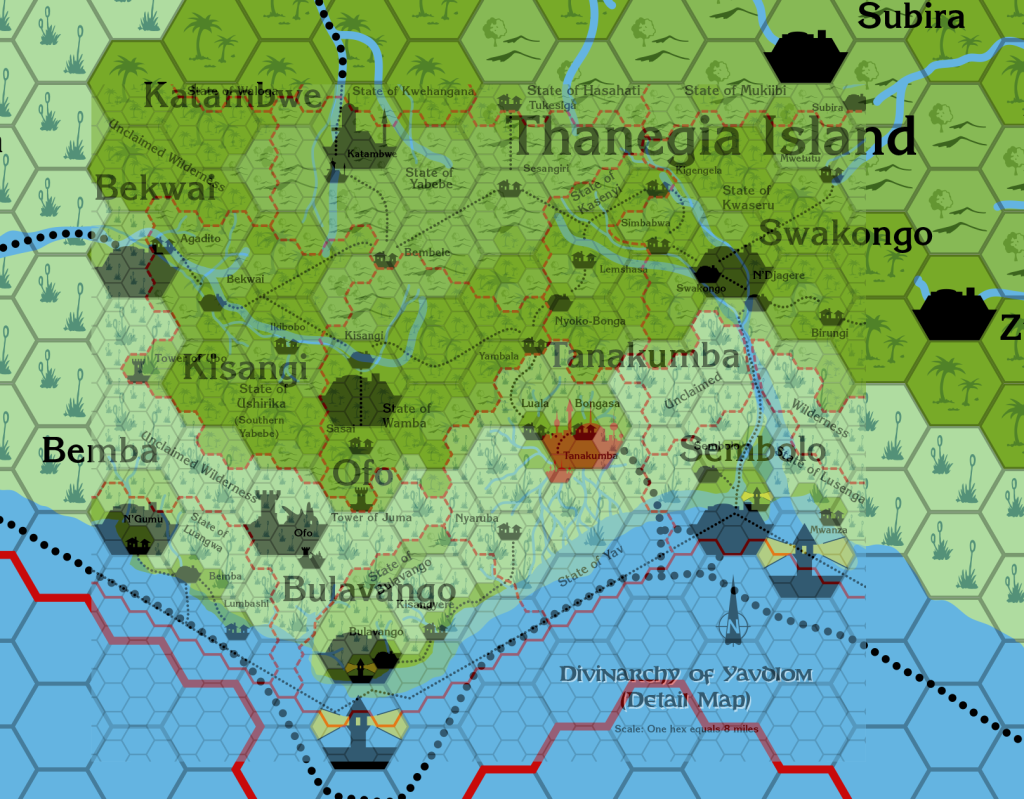
Yavdlom 8 & 24
Yavdlom’s 8 mile per hex first featured in Dragon 170. It later reappeared in Champions of Mystara, with two more rows of hexes added in the north, along with the reimagined 24 mile per hex Serpent Peninsula map.
As it turns out, they don’t match up all that well. The best fit I could find left a few settlements in the west in out-of-sync positions, but there’s no way to make everything align perfectly. In any case, the 8 mile per hex map is clearly the superior source, so the 24 mile per hex map will require some fixing.
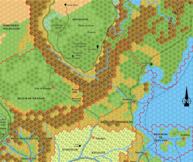
Hule
X5’s Hule is the only official source for the area, bare as it is. It actually fits quite nicely with X4’s Great Waste, with a clear overlap, although there are some changes to the mountains in the northern part of the overlap. Nothing major, though.
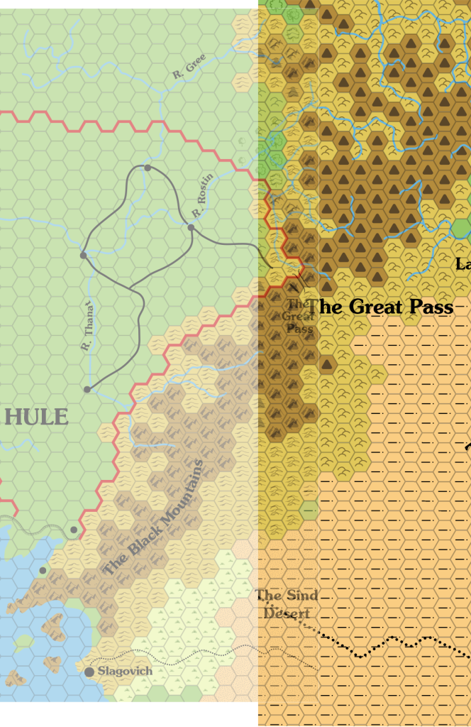
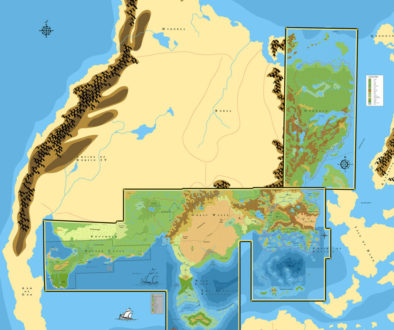
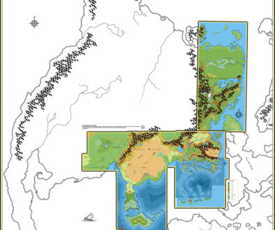
And here’s how it lines up with the Great Waste map from Champions of Mystara:
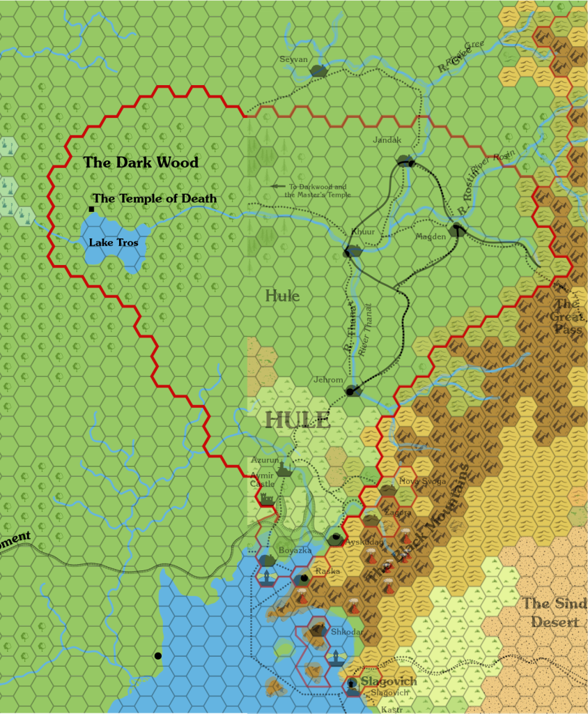
Not bad at all. It is obviously adding a lot of detail, and that’s fine.
The other thing to note about X5 is the Great Escarpment. This was largely missed out of Red Steel‘s poster maps. I can’t say this is a surprise, given what they did with the Great Waste on those maps; it seems likely that they just made things up without referring to all of the existing maps. Consequently, the Atlas considers X5 and other sources that conflict with Red Steel to have precedence.
Someone already brought the Great Escarpment up over at The Piazza — does anyone know who, or have a link for the thread, or their map?
Isle of Dawn
Dawn of the Emperors‘ poster map is the main source for the Isle of Dawn. It’s 24 mile per hex, but a section of the Isle was featured on TM2 at 8 miles per hex. It overlays quite well:
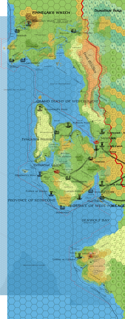
There is a minor problem with the coastline in the southern part, the Provincia Septentriona. It’s about half a hex out. I don’t think this is a major issue; we can simply adjust the coastline here accordingly.
With the Isle of Dawn’s position and extents fixed in, we can now use it as a reference point to align everything around it. Let’s start with Alphatia, then move to the southern isles.
Alphatia
Alphatia’s position relative to the Isle of Dawn is shown on the latter’s poster map. For whatever reason, surrounding land masses were left off of Alphatia’s poster map, even though it should show Bellissaria as well as the Isle of Dawn. Both poster maps are from the Dawn of the Emperors boxed set.
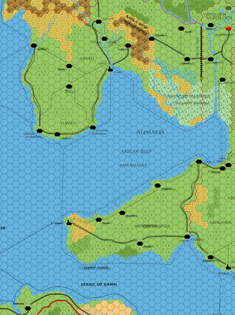
All the major terrain and settlements line up, but the coastline was out a fraction of a hex on the Isle of Dawn map. It’s an easy choice to go with the alignment of the Alphatia map, which of course shows the whole island continent. So we get the positioning from the Isle of Dawn map, but use the coastline from the Alphatia map.
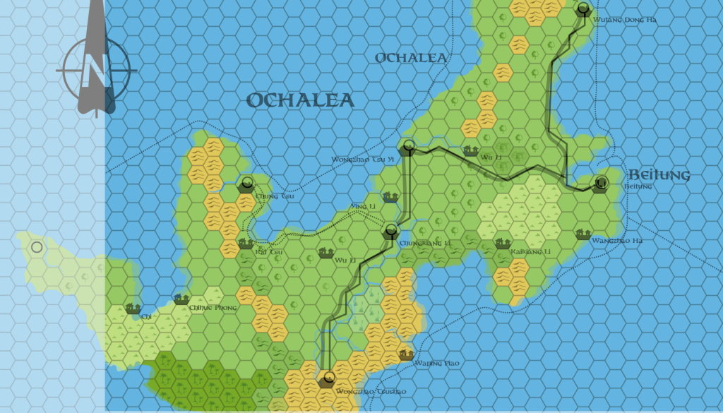
Ochalea
The Isle of Dawn’s poster map shows most of Ochalea. The rest was included in a black and white map in the Dawn of the Emperors DM’s book. Even though it doesn’t show the whole island, the poster map has more detail, so as a source it has precedence. We can use the black and white map to complete the island, like this:
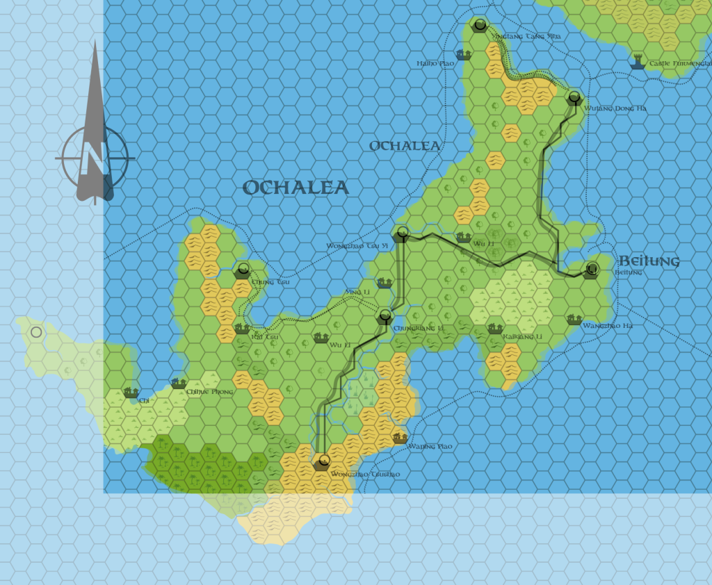
Interestingly, later maps of Ochalea (both official and fan-made) tend to show very little detail in these extra areas.
In any case, it lines up fine. I will go with the coastline from the poster map, expanding it using the map from the DM’s book.
The Pearl Islands
The Pearl Islands are detailed in 24 miles per hex on another black and white map from Dawn of the Emperors‘ DM’s guide. But part of the biggest, Nuar, appears on the Isle of Dawn poster map. As you can see, they line up pretty well:
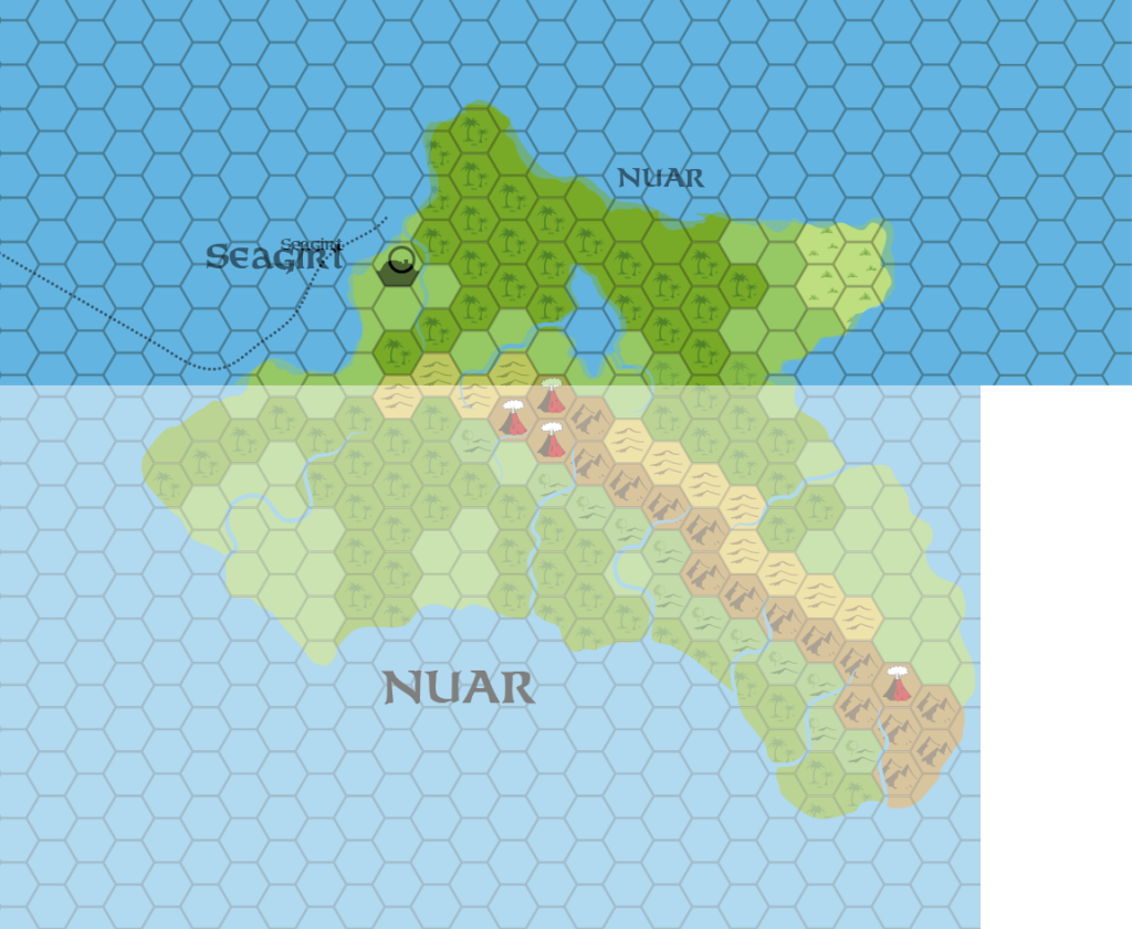
With very little difference between them, it’s just a matter of picking which coastline to go with. I’ll probably take the most interesting features of both, and create a hybrid.
The Alatian Islands
The last set of small islands on Dawn of the Emperors‘ maps are the Alatians. These were mostly shown on the Isle of Dawn poster map, but as with Ochalea and the Pearl Islands, the remainder were shown in black and white in the DM’s guide.
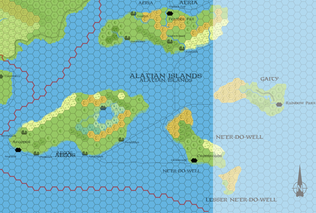
It’s another easy addition. One peculiarity not visible here is a strange black line running across Ne’er-do-well — perhaps a river? But it runs from coast to coast, cutting Crossroads off from the rest of the island. If it’s a river, it’s a very peculiar one! I couldn’t find anything about this in the descriptions of the island, so for now I have disregarded it. Does anyone have any idea what it’s supposed to be?
30 December 2015 @ 7:36 am
You say; Someone already brought the Great Escarpment up over at The Piazza — does anyone know who, or have a link for the thread, or their map?
Look here;
http://www.thepiazza.org.uk/bb/viewtopic.php?f=3&t=14611
by carrillion
31 December 2015 @ 9:34 pm
Robin, thanks for the link!
Lining Up Mystara I – Thorfinn Tait Cartography
31 December 2015 @ 8:27 pm
[…] Serpent Peninsula (Lining Up Mystara III) […]
31 December 2015 @ 8:49 pm
Excellent work, Thorf! Good catch on Thanegia Island, I was not aware of the misalignment.
Some minor comments on my side.
Hule: another source for eastern Hule is the large, non-hexed color map from “Savage Coast” boxed set. Here it seems that plains are more likely steppes, while the city of Kuur is called Kizil. What about a “double city” built on both sides of the river with different names? Real world example: Budapest (Buda+Pest)
Alphatia: the lack of nearby landmasses on the 24mi/hex is a real disappointment, I agree. Years ago I tried my own approximate match here:
http://www.pandius.com/Metropolitan_Alphatia_in_detail_01.jpg
Moreover, as you see, the 72mi/hex map should show on its northern edge also the southern tip of an island belonging to the same archipelago Orol Island belongs to.
Ochalea: in Mentzer’s map a small island is shown along Ochalea’s SW coast, which was never included in following hexed maps. What is your opinion about this island (and similar missing islands like the two westernmost landmasses of the Pearl Islands)? My personal opinion is to keep all of them, as the setting is lacking minor islands outside of the Sea of Dread. Opinions may vary, anyway.
Pearl Islands: see above about the missing islands. Notice also that the “atlas” description in PWAI lists an additional total area of “minor islands” not shown on the maps.
Alatians: I suggest you to check out also the map of Aegos in WotI’s adventure book, as it seems to me that some geographical features are different from DotE. I may be wrong on this, anyway.
3 January 2016 @ 11:39 am
Thanks for your great comments! 🙂
I just posted a whole article dealing with the Savage Baronies map, inspired completely by your first note. It led me to some surprising discoveries, too — I had been avoiding that map, due to its peculiarities.
Regarding the world map’s extra islands, I agree with you completely. I will definitely be adding all of these back in, probably using a localised best fit of the world map on neighbouring islands in order to get their exact scale and location.
Your Pearl Islands comment is interesting. I think that it’s always okay to add in extra small features when detailing an area, including new islands. For areas that we only have in 72 miles per hex, this is especially true, but even 24 miles per hex maps should be considered fair game — especially if the island or feature in question is smaller than a single 24 mile hex.
So for the Pearl Islands, there could and probably should be a plethora of smaller islands scattered among the major ones on the maps.
About Aegos: at a glance, I couldn’t find an Aegos map… I’ll have another look later when I get a chance.
1 January 2016 @ 8:28 pm
Yavdlom is definitely a mess. I tried to work it out a couple of times in the past, and always ended up giving up in frustration. Ultimately, I agree with you that going with the 8 mile hex map should hold precedent, but it definitely creates a mapping nightmare when trying to reconcile the 24 mile hex map.
The Septentriona one is one that I encountered when working on the southern half of the Isle of Dawn as well, and as you note, it really doesn’t change much overall. I didn’t get up to that area in too much detail in the 8 mi hex mapping (just an outline), but I vaguely remember addressing it and sharing my map with Mark Howard when he did his southern Isle of Dawn 8 mi hex map, and I believe he either copied my version or otherwise rectified it on his own.
2 January 2016 @ 2:58 am
Thanks, Andrew. 🙂
It does look like the 24 mile per hex map would end up being a bit of a mess for Yavdlom. One thing that can help this is using the smaller settlement icons, which to be honest are much more fitting for this scale than the full hex icons. I’ve always planned to do this myself — you only need to look at the Known World map from Wrath of the Immortals to see why this is so, it’s just so crowded.
There may have been an element of moving things around on the Yavdlom 24 mile per hex map, just to make things look better.
I remember talking with you about the Isle of Dawn. I’ll certainly refer to your maps and indeed Mark Howard’s when I come to deal with that area at 8 miles per hex — which seems likely, as I’m aiming for a contiguous set of trail maps from the Savage Coast to Alphatia at some point in the near future.
5 January 2016 @ 2:36 am
Just to complete my comments: Aegos map is actually shown in the 48 miles/hex WotI’s map. The villages of Pittston and Selenion are included (Selenion is very likely also shown in DotE’s black and white map but the village’s name is missing).
Notice also that:
– Gaity plateau is reversed with respect to DotE’s map
– WotI’s map represents also another source showing the link between the Alatians and Bellissaria. I believe I actually used this map as a reference for my homemade map of Bellissaria.
5 January 2016 @ 2:26 pm
Aha! The 48 mile per hex map. Thanks for reminding me — I must add it in to my master file, and see how it fits. If my memory serves me correctly, I believe it is very much in line with the 72 mile per hex maps. But I may be misremembering. I may write an article about the map, dealing with its uses all in one go.
Gaity — interesting. Dawn of the Emperors had Rainbow Park on a ridge, with a series of lakes beneath it. Wrath of the Immortals has just the river (though the scale is likely too small to show pools anyway), and has it running on top of a ridge which looks down on Rainbow Park. I think I would go with the larger scale map, since it shows more detail. Do you have a preference?
8 January 2016 @ 5:39 am
About Gaity I’d go with the solution already shown on your map (i.e. Rainbow Park below the cliff), as it seems to me more believable to have lakes and a winding river because they were stopped by the cliff.
Notice also that the 48 mi/hex would show another solution for the Heldann/Norwold junction. Moreover, hexes NW of Denagoth are pretty different from the same region of DotE 72 mi/hex map.