Lining Up Mystara VII
Here it is, what you’ve been waiting for:
The Norwold Confusion
So what’s the big deal about Norwold? Well, for more than 10 years, I’ve been making references to Norwold being a headache. Anyone who has tried to fit together the maps themselves will already know why.
To put it bluntly, they just don’t fit. What to do?
Let’s take a tour through this mess, and see if we can get it sorted out once and for all. I’m writing this article to record my thought processes, and I’m the first to admit that I don’t know what the solution will be — and I won’t decide until I reach the end of this article.
So roll up your sleeves, and let’s get started!
CM1/M2 Norwold
Norwold was introduced in 1984’s CM1 Test of the Warlords. The same map was presented again in 1986, in M2 Vengeance of Alphaks. You can see my combined replica of these maps over at the Atlas of Mystara.
CM1 gives instructions for lining up this map with the Expert Set/X1’s Known World map on page 4:
Norwold lies to the north of the land shown on p. 33 of the D&D Expert rule book. To see how the Expert map relates to Norwold, line up the coastline near the bottom left corner of the map shown on this adventure’s inside booklet cover with the coastline at the top of the Expert map (near the Heldann Freeholds). If you want to see more of the Expert/Companion world, you may line up the players’ map with the map shown on p. 16-17 of adventure X i , “The Isle of Dread.”
Here’s what results from this:
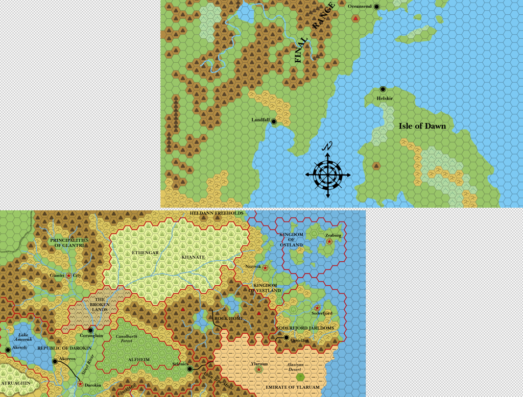
This was likely fine back in 1984, but unfortunately there are a number of problems with it now.
The first major problem is this:
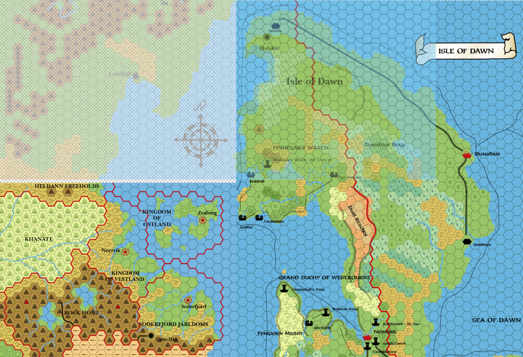
Look closely and you will see that CM1’s Isle of Dawn is tiny compared to the one we are used to from Dawn of the Emperors. The scale is completely out. This is a very regrettable problem, because under normal circumstances we could have used the Isle of Dawn as a reference location to place Norwold.
Helskir
All is not completely lost, however: the position of Helskir is only a few hexes out. We can also see that it was placed on the coast, while Dawn places it a couple of hexes inland:
Check the comments on that Facebook post for Bruce Heard’s view: Helskir is definitely a port, and according to Bruce it should be situated one hex to the northwest, on that little bay. It looks like the best location for it. Here’s how this will look on my updated map:
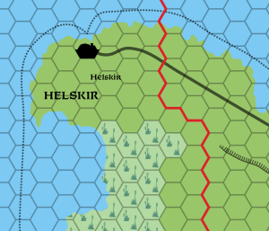
Helskir is a useful candidate to be a landmark for placing Norwold. We already have the Isle of Dawn fixed in relation to the Known World, but the scale problem means we can’t use the coastline. The position of Helskir, however, lined up pretty well between both maps, so it may well turn out to be the best location.
Incidentally, Simone Neri used Helskir’s position as a key step in creating his updated Norwold map, as outlined in Threshold Issue 7 (page 6). So I’m in good company here. 🙂 Given the great work he has done, I will be very happy if my solution is compatible with Simone’s.
X11’s Wendar, Denagoth and Heldann
Next up is to check how X11’s map interacts with CM1’s when joined up to X1’s Known World.
The join between X1 and X11 seems to be pretty straightforward, except that it goes out of sync half-way through:
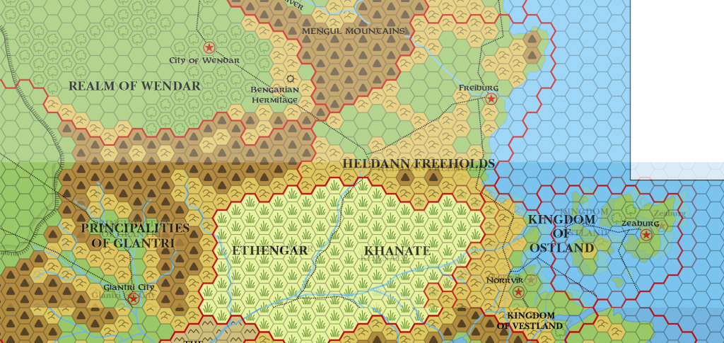
Look closely at Ethengar and you can see that a row of hexes has been missed out in the middle on X11. (It’s not terribly clear which map from this picture, I know.) This in turn causes all of the right hand side to be misaligned, with Ostland clearly a hex shifted out of sync. The left hand side — the western half of Ethengar and all of Glantri — lines up perfectly.
We don’t need to make an arbitrary decision here, because Wrath of the Immortals has already decided whether to line this map up with the east or the west. As it turns out, it’s the west that it lines up with, and the southeastern section can be ignored entirely. We can clearly see this when overlaying Wrath‘s 24 mile per hex map with X11:
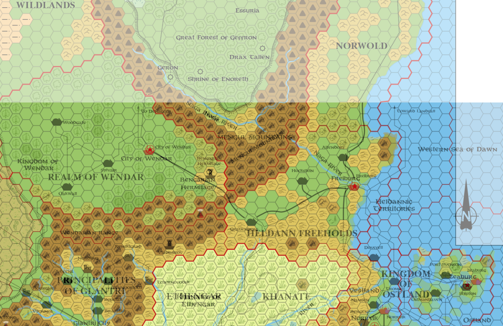
It’s a bit of a mess, but you should be able to make out how well the west lines up (as it did with X1 — Wrath is generally a good fit with X1, at least when it comes to lining things up). Note that Ostland and eastern Ethengar are still out of sync, but Wrath has nevertheless adopted X11’s version of Heldann. Finally, and crucially, you can see that the Denagoth plateau’s southern point matches almost perfectly.
So we can lock in the Heldann, Wendar and Denagoth portions of X11’s map, and ignore its overlap with the Known World nations.
But how about its overlap with Norwold?
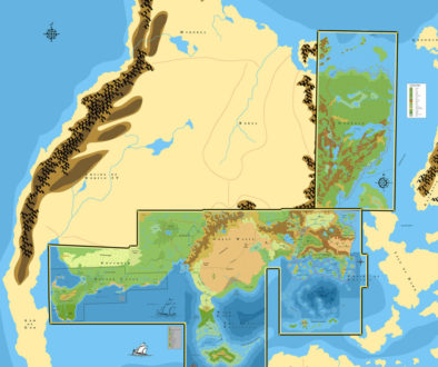
Using the previously established position of CM1 in relation to X1, this is what happens when we add in X11:
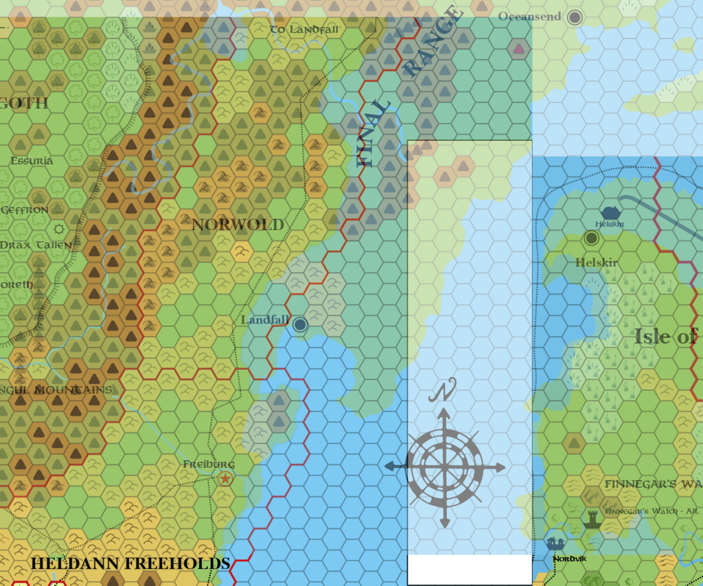
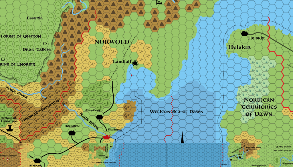
It’s not pretty. First, the bottom left of CM1’s Norwold map — in other words the Heldann area — is totally different from how it appears on X11. The coast is different, the terrain is different — pretty much everything. Second, if you merge the maps, Landfall seems way too close to Heldann, and the bay it’s on is far too narrow. This looks quite different to how the area looks on the continental map — also from CM1 (here’s my colourised replica for reference):
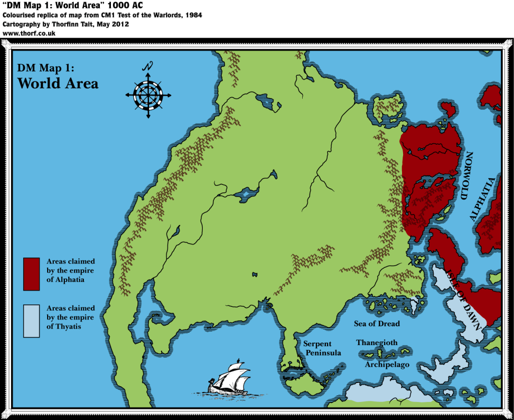
So this is no good. What to do?
Back to Helskir
Let’s try lining up Helskir on the CM1 map with Helskir on my updated Isle of Dawn map — that is, move Helskir to the coast on Dawn‘s map, then align CM1’s Helskir on top of that.
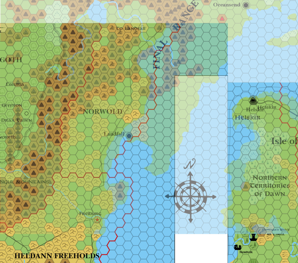
This is looking a little better. The overlap with Denagoth is of course useless; clearly CM1 did not take account of Denagoth, which is no big surprise since it predates X11 by two years! So we can safely ignore Heldann and most of Denagoth. All we need to do is work out a compromise for the border area — and in general it looks like that could simply be to combine all the mountains into one big range.
We still need to check this with some other, more recent maps. I will leave that for next time.
But there’s one more thing I want to do before winding up: let’s check this against Simone’s revised map, and see how they fit together. Fingers crossed!
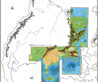
First, here’s a bit of a hack together of Wrath‘s Known World, my updated Isle of Dawn, and X11:
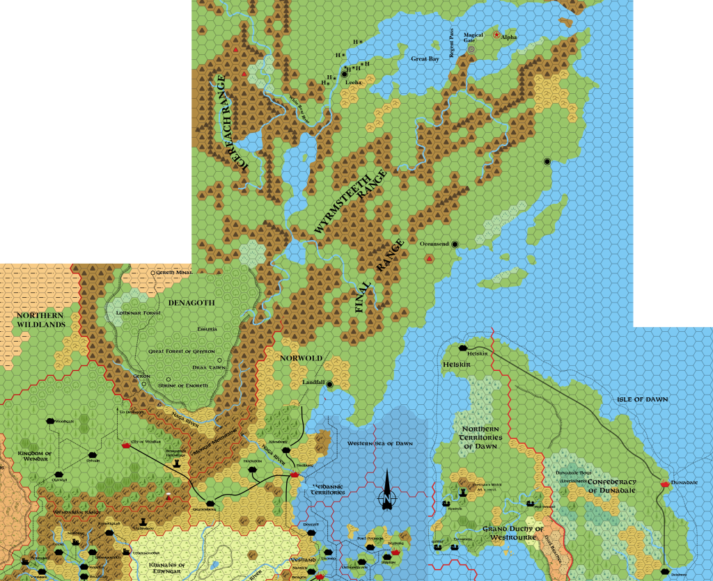
These are not the final terrain choices — this is just a quick hack to get a rough idea of what sort of shape the land will have.
It looks not too bad. I’m not sure I’m happy that Landfall is so close to Freiburg, but it’s actually two hexes or so north of where it was just placing the maps together. So I guess this is fine.
Now for the big test. Here is what happens when we overlay Simone’s map on top of this:
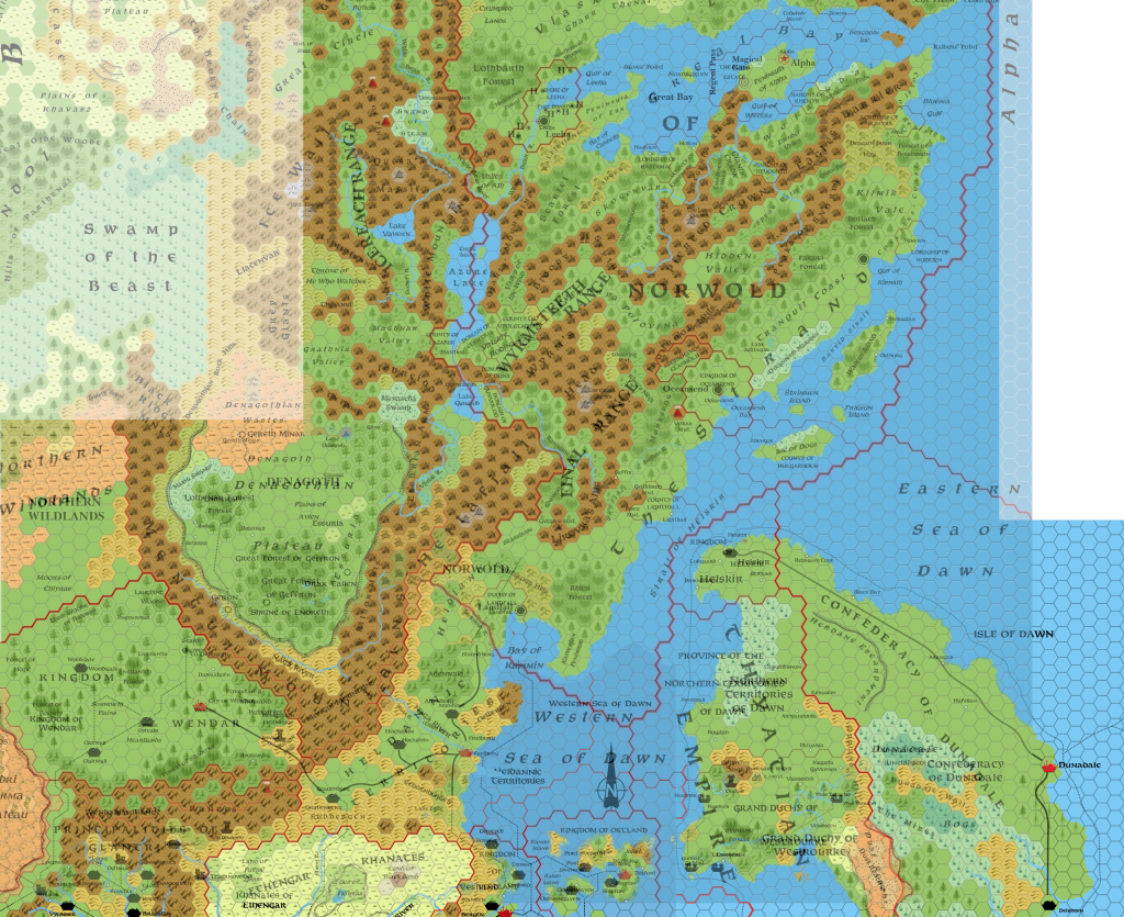
EUREKA!!!
Helskir’s location is actually different, but only because Simone chose a different coastal location from me. Otherwise, it lines up almost perfectly.
This is a very serendipitous result indeed. Not only does it mean that the Atlas of Mystara will be roughly compatible with Simone and the Italian Mystara community’s placement of Norwold, but it also means I can take advantage of the meticulous work Simone has done to detail Norwold.
And that’s it for now! Many thanks to everyone who chipped in on Facebook while I was writing this article, about Helskir’s location and other questions. And especially to Bruce Heard for his input on ports, and Simone Neri for making such a great map — I’m so happy we’ve come to the same placement, even if our roads were a little different.
Until next time…
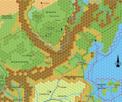
Lining Up Mystara I – Thorfinn Tait Cartography
13 February 2016 @ 9:00 pm
[…] Norwold/Known World & Northlands (Lining Up Mystara VII) […]
Let’s Map Mystara 1984 – Thorfinn Tait Cartography
6 November 2018 @ 10:37 am
[…] previous attempt at tackling this problem, in 2016’s Lining Up Mystara project, resulted in cutting up the Brun map and placing the pieces back together as best I could. It […]