Lining Up Mystara X
I couldn’t resist playing with the 3D model a bit more.
Specifically, I noticed that the way I had applied the maps to the model yesterday was not right. Count the latitude lines on this image from yesterday and see for yourself:
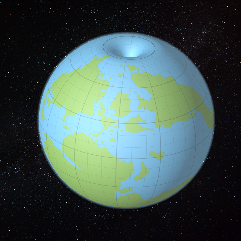
Notice how nine small squares fit into the space between the equator and the extreme northern point of the world? This is why I had to stretch the continents to make them fit more into the polar openings. Do you also notice how the squares are not in fact square, even near the equator? They should be almost square at the equator, getting squeezed more and more as you near the pole. But they’re squashed into rectangles at the equator.
In other words, the map is not correctly applied to the globe. The Outer World should go further into the polar openings, and the Hollow World shouldn’t be poking out the top quite as far as it is.
Unfortunately there is no super precise way of doing this, but that’s okay — unlike with the real world, this globe is just a visualisation of the maps, so it doesn’t have to be pixel perfect, as long as I can get it to look roughly the same each time I make it.
So I reverse-engineered the graticule (the grid lines) so that 66º sits roughly at the start of the polar opening, then squashed the Hollow World graticule to compensate. Here’s what the texture map has to look like for this model (prepare for weirdness!):
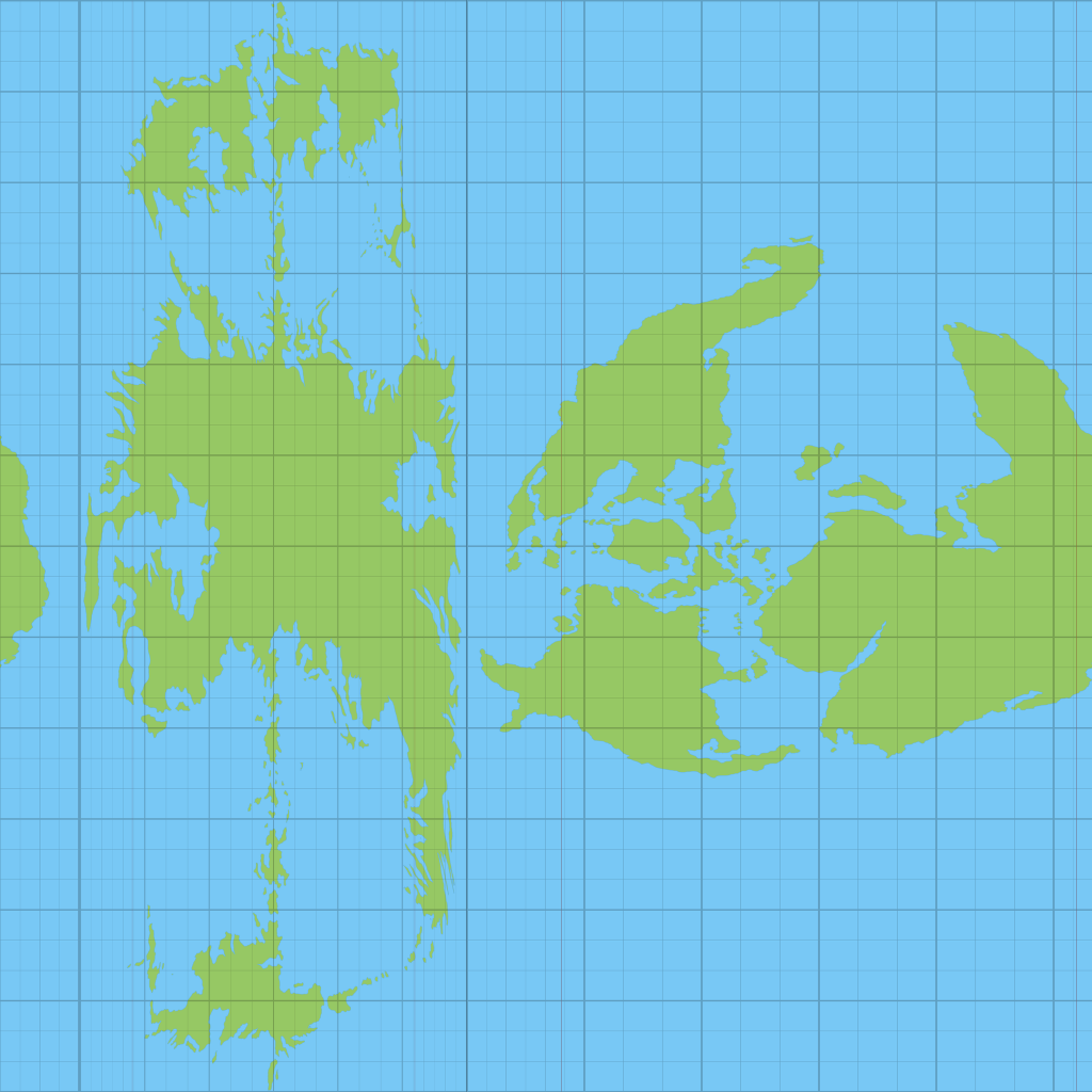
Each part of the map has to be squashed into the texture in order to display on the model correctly. And for some reason it all has to be vertical like this!
Apply it to the globe, and…
The Revised Globe
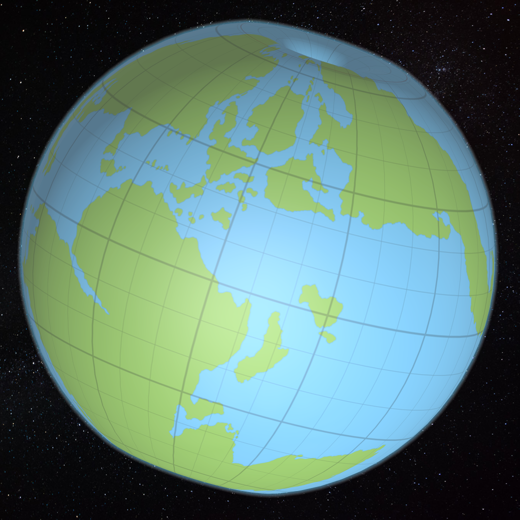
Much better!
Note that the graticule squares are indeed almost square near the equator.
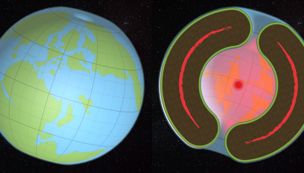
Let’s take a look inside, too (complete with an improvised Red Sun):
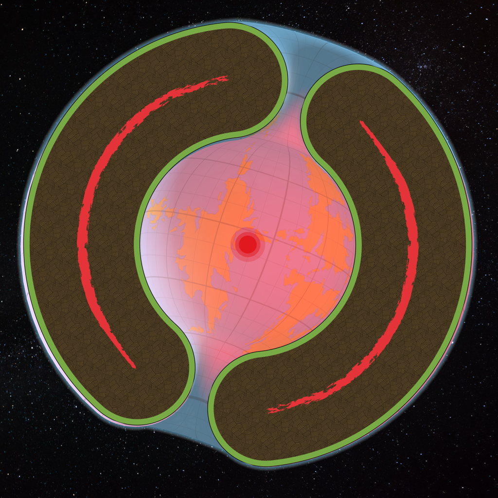
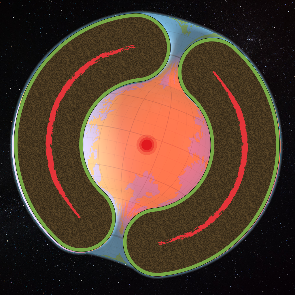
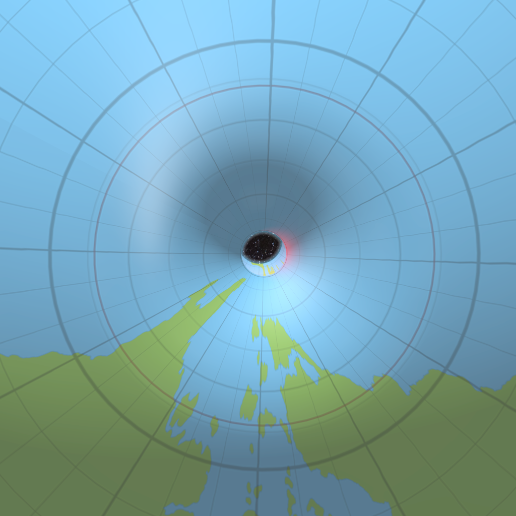
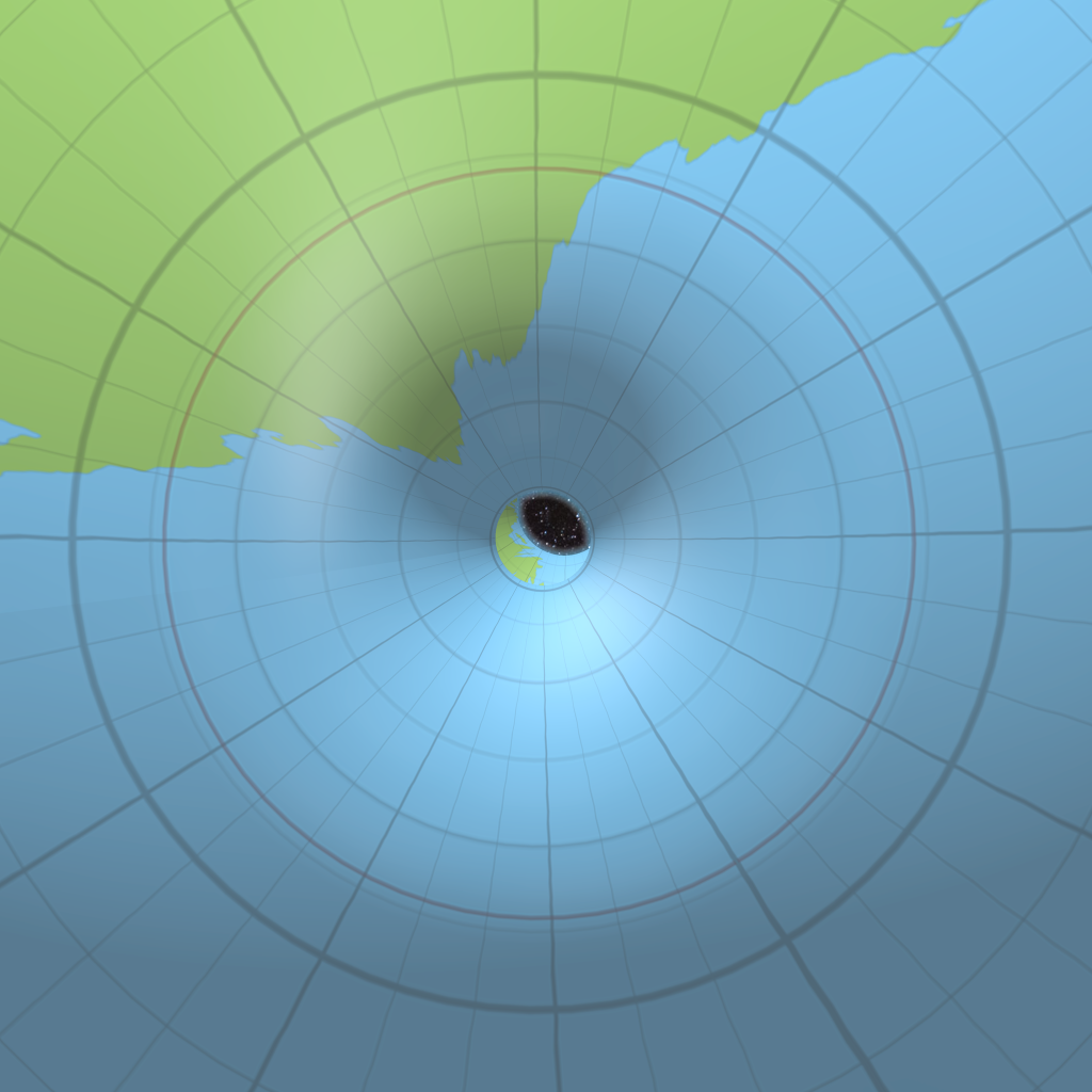
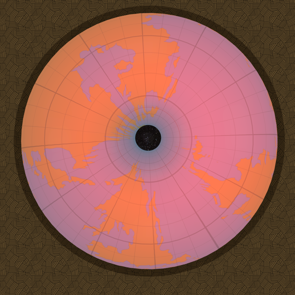
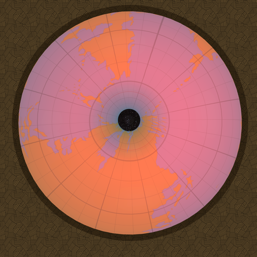
Does anyone have any objections to these placements of the two worlds? There’s lots of room for tweaking, but in general I’m pretty happy with this configuration.
We should probably get the exact dimensions of the world locked in before playing with this stuff any more. Changes to the size of the Outer World will doubtless cause changes to the model anyway.
24 January 2016 @ 3:30 am
It feels like this is as close to the best that can be made with this funny-shaped world. ?
I have wild thoughts imagining what the seasons are like in the polar openings. For months it is dark 24 hours, but the other side of the year the sun can be nearly directly above you in midday, getting higher in the sky the further “up latitude” you get as if you were in the subtropics, as the sun peeks the over the lip of the rim. Amazing seasonality!
Then we have the eternal darkness further in the hole.
24 January 2016 @ 12:53 pm
Don’t forget the perpetually awful weather — permanent thick clouds, high winds, rain and snow. So even if you’re outside one of the areas of eternal darkness, it’s still going to be pretty dark.
Oh, and on top of all of that, magic doesn’t work.
25 January 2016 @ 12:51 am
I like it very much, although I feel that the polar sections the map is a bit crumbed.
25 January 2016 @ 1:45 am
I know what you mean. The distortion is what it is if we assume the latitude in our sources have been correct all along. Distortion is the eternal problem of cartography, converting 3D spherical reality onto a 2D surface.
I WANT northern Brun and Skothar to look like it does on the old maps. But in a way that’s also like saying “But I want Greenland to be larger than South America because the map shows it is.”
25 January 2016 @ 1:48 am
The squashing is due to a squarish map being applied to a sphere (or a strange apple-like shape in Mystara’s case). There’s not a lot to be done about this, although I will be able to redraw the pinched areas slightly to try to maintain their shapes a little.
25 January 2016 @ 8:08 am
Very nice.
I have no idea if this is right or wrong, but it looks great.
I’m wondering about the curvature of the areas around the Polar Openings. Is this caused by the same sort of gravitational force that turns asteroids into spherical planetoids, once they reach a certain size? In other words, Could someone walk from the Known World to the Hollow World, around your curve and constantly feel a downward force below their feet?
25 January 2016 @ 8:18 am
Regarding walking around through the polar opening, yeah it could be done while dealing with the bad weather and anti magic and eternal darkness.
But why curved like it is? ¯\_(ツ)_/¯ The immortals made it that way when they carved out the Hollow World. 😉
Lining Up Mystara XII – Thorfinn Tait Cartography
13 February 2016 @ 11:32 pm
[…] This is just placement 1 with latitudes redefined so that the landmasses stretch almost to the limits of the world. This should result in a placement similar to the one I modelled back in Lining Up Mystara X. […]