Let’s Map Mystara!
How about this for an idea…
Writing the commentary for all these old maps I’ve been re-releasing lately has crystallised something I’ve been wanting to do for quite a while now.
Why don’t we do a “Let’s Map Mystara”?
I’m sure you’ve heard of “Let’s Read” — a Mystara-themed one over at RPG.net has been on the go since 2014. The idea there was to read everything Mystara, in chronological order. Of course this was a massive undertaking, and it’s still not quite finished even now, almost four years later.
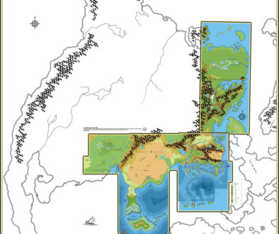
What I’m proposing is to do a “Let’s Map”, where we start at the very beginning, with the 1981 X1 map, and slowly work through the whole published canon in chronological order, gradually adding each new thing to the body of maps as we go. Not only would we get a very clear view of how Mystara evolved through its publication, but we would also of course build up the complete body of maps in the process.
Of course, I’ve already done this in numerous areas, and I’ve already reproduced the vast majority of these maps. So there would be some repetition, but most of the legwork is already done.
Moreover, this is something I’ve always had planned for the Atlas of Mystara — it’s in my earliest plans, and I made reference to it in my project announcement and overview back in 2008. At that stage I envisioned an article on “The History of Mystara’s Maps”, but it’s so wide-ranging that I’ve never worked out how to present it — until now.
So what does this involve?
Here’s how this will work:
- First, I post a replica of a Mystara map.
- Next, this is where you come in: we all raid the relevant text for details to add to the map.
- I add the map and all the info we have come up with to our master maps.
- Rinse and repeat.
Details to add to the map include the obvious stuff such as settlements, landmarks, and terrain labels, but also less obvious things, such as those implied but not explicitly spelled out, as well as geographic and/or geopolitical data that can be added to the map’s GIS database: population figures, important NPCs — anything that can be linked to a geographical location.
You may be wondering how this data will be used in the map. The answer ties directly into another part of the Atlas project, also long planned but not yet publicly released: a Mystara web map.
As the project progresses, we will build a series of master maps, one for each scale level, splitting them again when they become too unwieldy to work with. At the same time, we will be building a web map.
Won’t this take a long time?
I started the Atlas project in October 1999, but quickly abandoned it due to a lack of CPU power. I picked it up again in 2005 and have been working on it on and off ever since.
Which is to say: yes. Yes, it will.
I don’t intend to rush through it. It will likely take a long time, and in fact it requires time for it to work properly.
I’m in this for the long haul.
It’s also worth mentioning that this is something I’ve been doing in the background all along; in many ways, this would simply be putting the process out in public — something I’ve already been doing with other parts of the Atlas project from the very start.
So what do you think?
I guess I should note here that I would like to keep things positive, avoiding negative commentary; as a cartographer, I tend to view everything in terms of things that can be added to the map, and finding these little nuggets is a lot of fun, regardless of personal feelings about their worth (or lack thereof). Moreover, negativity makes for poor reading, and I was sad to see the Mystara Let’s Read that I mentioned earlier dragged down by this at points. I’d rather avoid this.
The first task, to kick things off, is to make a list of all the maps in chronological order. Once that is posted, I will start by posting the X1 (1981) Known World map with a short commentary, and open the floor up for research of that module.
Does this sound like something worth doing? Would you be interested in following along, or chipping in and helping with research?
I’m sure there will be many surprises and fun discoveries along the way.
Addendum (August/September 2020)
Things haven’t quite worked out as this initial post laid out. The main point of difference is that while I initially envisioned community involvement, it ended up being mostly just me.
I’m not complaining — on the contrary, I’d like to thank everyone for all the feedback you’ve given me so far. To be honest, it was probably inevitable that it would turn out like this, because the nature of the project is that most of it remains hidden until I post the results. That doesn’t leave much room for other people to contribute.
The biggest reason for this is that I have split the project up into years, presenting each year’s maps as a single post. I did this to keep things manageable, but also to allow me to maintain motivation by skipping around the maps within each year, so that I can take a break from tackling a particularly difficult map by adding one of the easier ones.
In any case, here’s how things are currently working:
- Listing the Maps — I assemble a table of the maps released in the target year.
- Creating Replicas — I complete replicas of any maps that haven’t yet been duplicated, and make sure all are posted at the Atlas.
- Analysing the Maps — For each map, I review the replica, noting Additions (first appearances), Revisions, Hex Art, and Fonts. I also make sure it is properly georeferenced — in other words, I make sure that it fits properly with the other maps up to that point. Then I tag every feature of the map with its source.
- Analysing the Texts — Once I’ve done all the maps in a product, I review the text, assembling a list of Textual Additions — stuff that can be added to the maps.
- Putting it All Together — I then add all of this to the project’s compiled body of maps, either as new maps or as additions to the existing maps, smoothing out continuity between the pieces as I go.
- Publishing — Once the compilation of maps for the year is complete, I post the article here at www.thorfmaps.com, and add a new page to the Atlas of Mystara for that year.
- Expanding the Atlas — Finally, I add the lists for each map to their page in the Atlas, so that the content is right where it needs to be for easy future reference.
Does it sound a bit complex? It’s certainly a bit more involved than I expected.
If you would like to help out in some form, please drop me a line. Feedback is the thing I need the most — not just to catch my mistakes, but also to keep me motivated and on track.
8 April 2018 @ 11:02 pm
Nice idea…
I’m doing something weewat similar…as in my 1-mile hex mapping, I have to research a lot (a heck of a lot….actually a tremendous lot of information canon, fanon and geological, ecological, social and combinations thereoff). There are many flaws in the canonmaps due the various artists not regarding all information of the other artists; one added altitudes this, the other that on their own maps without taking consideration with the other maps…, and then campe the printers where they missed items drawn by the artists, moved them (often to really faulty locations; example the waterfall in the middle of a swamp in the Broken Lands…which is ecological geological and altitudial flawed)..but hey ..we as fans are there to correct, and update these sources.
You may always use my maps in this project, and i’ll pop-in now and then to give ideas, remarks and such..so count me in. ;P
8 April 2018 @ 11:07 pm
When I began work on my Rearranged Known World maps I read everything I possibly could get my hands on. I wanted to get a feel of the surroundings so the rearrangement could work. I broke Hexographer because the map got too large, kind of demoralizing after you spend that amount of time only to find the tools you used had an invisible limit that would destroy your work if you bumped into it. ¯\_(ツ)_/¯ I walked away. My computer is 9 years old now, when I buy a new one I might dip into it again and see if the software improved.
When I was doing it I wished there was some community I could pull help from to research. While I couldn’t commit to helping now, I think reaching out to find people who have time to aid is worthwhile. I’ll still be lurking on.
9 April 2018 @ 1:05 pm
Great to have you here, Eric!
Your technological barrier sounds very similar to mine back in 1999 — except that I stopped far earlier, as soon as it became clear that my computer wasn’t up to it. In fact all I had done is draw out all the hexes, and I stopped right after starting the first map, when the computer ground to a halt. Luckily I was able to keep everything, and in fact the settlement hexes are largely unchanged from how they were in 1999! All the terrain has been redrawn multiple times, though.
I hope you’ll find that the barrier has evaporated next time you get a new computer. I’d love to see more of your work.
8 April 2018 @ 11:11 pm
That’s wonderful Thorf – I’d be interested in following along. I’m not sure what negativity you’ve seen elsewhere (I’ve haven’t followed the Let’s Read Mystara thread) – I hope my comments haven’t come across as critical. Sometimes I make brief comments (e.g. about something that could be added to the map) just because I’m in a hurry – I hope they don’t come across as negative – your maps and vision are awesome.
9 April 2018 @ 1:11 pm
Travis — don’t worry, I have never found your comments to be negative — quite the opposite. What I find off-putting is criticism. (I actually studied English Literature at university and hated it for the same reason.) In the Let’s Read thread, the constant labelling of developments to the setting somewhat pejoratively as “ret-cons” got old really quickly. I’d prefer to be more inclusive and accommodate both people who dislike the newer stuff as well as those who love it — and this is the general policy of the Atlas, too.
Edit: I guess I should qualify that what I mean by “criticism” is the same as “literary criticism”. “The art or practice of judging and commenting on the qualities and character of a literary work” according to my computer’s dictionary. You could equally call it meta-analysis these days. What drives me away is qualitative discussions of aspects of the setting — in simple terms, “I like this, but I don’t like this”. Such conversations have value by themselves, of course, and I have no objection to people discussing their likes and dislikes — but since it comes down to personal tastes, they don’t seem very relevant to projects like mine.
The Atlas of Mystara wouldn’t be much use to people if I injected my personal views of Mystara into everything, after all. There is room for such interpretations — consider the wonderful work of Eric Anondson or Ignacio Ramos, for example — but it’s an explicit, unapologetic design choice.
I guess this all comes back to the question of “What is canon?” — another one that I’ve avoided over the years.
9 April 2018 @ 12:50 am
Yes! Let’s do this!
9 April 2018 @ 8:36 am
Could we potentially include some of the other maps (location, etc) outside the world map itself?
9 April 2018 @ 2:52 pm
And as Skothar is one of the last areas to get mapped, I would like to help you if I can. I am trying to develop areas that have only been mentioned. I’m more than willing to receive any advice or suggestions.