Lining Up Mystara Revisited V
It’s been a while since I’ve written a post for this project, but that’s not from lack of progress or activity — quite the opposite. In fact I’ve been repeatedly amending and revising a post for over a month now. Now it’s finally ready to share.
Planet Size
After the last article, I discovered that my calculations were a bit off. I’m not exactly sure why this is. I posted about this in the Facebook Mystara Cartographic Society (embedded below, if it’s working), and after discussions there (check the “Is my maths off in some way?” comment thread for details) decided to go with a round 36,000 miles for the circumference — primarily because chasing an exact 72 miles per hex was not working, and because this figure gives an easy 100 miles per degree.
Unfortunately, this didn’t work out either — it ended up giving far bigger hexes than I had expected, with 24 mile hexes coming out at 26 miles.
So I left it for a month or so. And then it hit me: I can reverse-engineer the circumference from measurements in Illustrator.
Basically, what I did was measure a hex, then divide the circumference by that number. Then I multiplied that by the desired hex size, which gave the actual circumference I needed to define the ellipsoid.
It turns out that Atlas Mystara has a circumference of 33,032 miles, which is quite a bit smaller than previous estimates. But this indeed made the measurements for hexes come out nearly perfectly in Illustrator, so I’m locking this in as our final circumference for the new 2018 model.
Phew! Now I just have to go back and re-georegister all those maps. Thankfully I already know how to do this without losing all the GIS data I’ve been inputting, and it’s not very hard.
As a consequence of all this, I have had to rebuild the model yet again — hopefully for the last time!
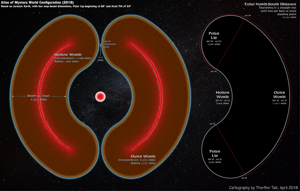
Oops… Looks like I spoke too soon…
Revisiting the Hollow World
After my experience with Jurassic Earth, it occurred to me that my hack-up of the Hollow World back in 2016 actually had an unfortunate effect that I’d rather avoid: it invalidates the projection of the official hex maps.
This is unacceptable. So it’s time to revisit the Hollow World.
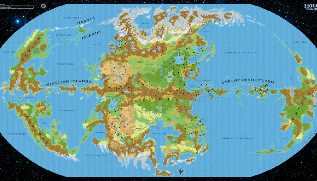
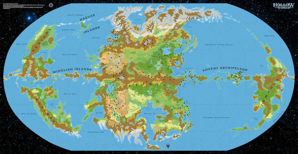
This time, I propose a far simpler take on things: georegister the map as a Robinson projection, and just go with it, scaling it to the 11,908 miles official circumference figure.
It actually works out rather well, with one hex being less than 1.5 miles over 40 miles — a very acceptable margin of error.
No, wait… Scratch that: with the Outer World hexes now at a near perfect size, I’m going to do the same for the Hollow World.
Running the calculation I outlined above for the Outer World with the Hollow World’s 8 mile hexes, it works out as follows: they currently measure 8.2236 miles. The current circumference of 11,908 divided by that gives 1448.028. Multiply that by our desired hex scale of exactly 8, and the ideal circumference should be 11584.2. Round that off to the nearest mile and we end up with 11,584 miles.
The rounding will mean that the hexes are not exactly 8 miles. But the error introduced here is less than 0.001 miles per 8 mile hex. In other words, the hexes are coming up as 7.999 miles rather than a perfect 8. I’m quite happy with this level of precision.
The reason for rounding is to allow pixels to be mapped to miles without any fractions. That’s extremely useful when it comes to Mystara’s 3D model, where everything has to be scaled manually to the texture map.
Now let’s get back to the map itself.
Note that while the world map doesn’t conform perfectly to the Robinson projection, it’s actually a surprisingly good fit. There are two main problems:
- The east and west hemispheres are not equal.
- The graticule lines don’t line up properly with the grid overlay.
These are actually both manifestations of the same problem.
I fixed this by aligning the grid to the map’s equator and central meridian, then scaling it so that the whole map fit inside the grid. The eastern edge ends up outside, while the western edge is well inside the grid, so I fixed this by cutting and pasting the easternmost equatorial islands to the western edge of the map. The end result is that they’re still in roughly the same position, but at the other side of the map.
This solution takes the map at face value, assuming that the grid lines printed on the map (which are unequal) are wrong, but the shapes presented on the map are correct. This will affect the warping of the extreme east and west slightly, but on the other hand it preserves the continent of Iciria very much as it appears on the hex map — and at the same time it allows all of the hex maps to be georegistered to a true Robinson projection.
The other main result of this new take on the Hollow World is that the land now stretches much further into the polar openings. This isn’t quite so desirable, but it’s the price that has to be paid in order to preserve the integrity of the hex maps — which, after all, is my prime directive in the Atlas of Mystara project.
As you may already know, I actually posted the finished map for the Hollow World almost a month ago over at the Atlas of Mystara. It already includes all of the revisions I have just outlined here.
Latitudes
Lately I rediscovered a discussion from 2016 with Bruce Heard that brought up some interesting points. It was in the Facebook thread for my final article in the previous Lining Up series.
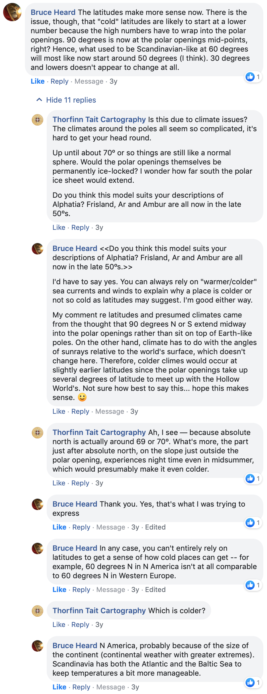
Basically, he theorised that cold climes would come a little further south due to the lower position of absolute north on the globe. This seems like an important detail for further work on Mystara’s climate in the coming months and years.
Up next: Exploring the revised 2018 model
With the Hollow World now in an almost complete state, and the Outer World getting closer to completion, it’s almost time to see how things look on the global 3D model once again. So that will be the subject of my next post. It will be the third or fourth time to do this; fingers crossed that it will be the last time for me to preview a new model!
