Lining Up Mystara XI
I’m back on the project for a final push after my usual heavy workload for early February. (It’s entrance exam season at work.)
Here’s where we were at back in Lining Up Mystara VIII:
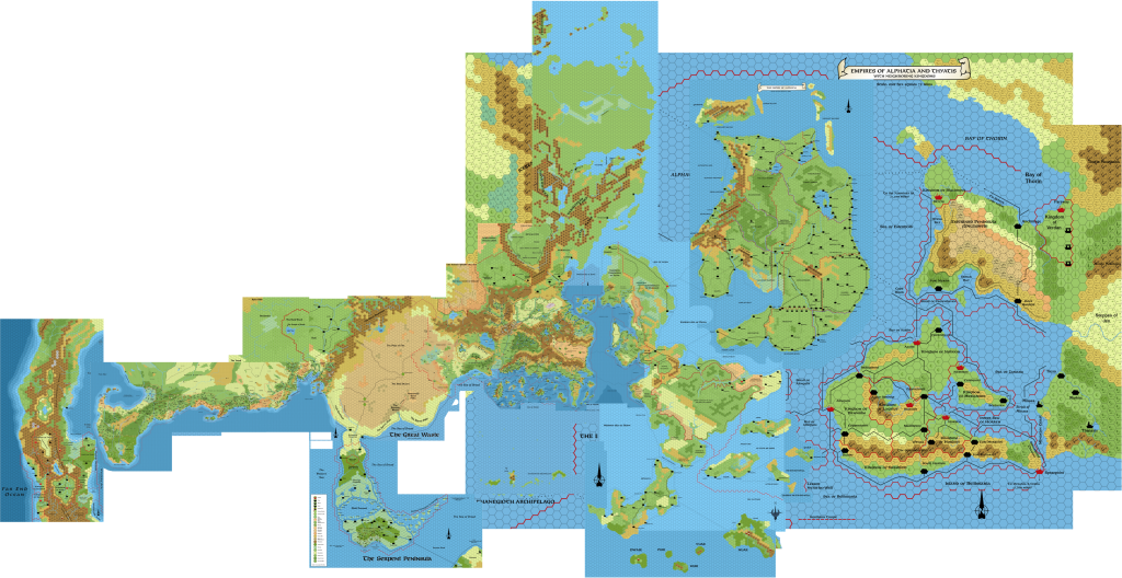
We’re almost out of hex map sources to add to this. Basically, there is just Davania left.
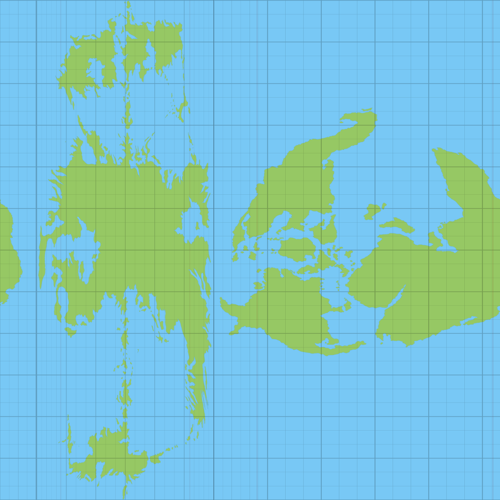
But before we get into that, let’s have a go at adding in the Master Set world map to this.
Reconciling the World Map I
Brun
Home of the Known World, centre of the whole setting — Brun is undoubtedly the best detailed area of the world. It’s also the most problematic in many ways, since the hex sprawl from the Arm of the Immortals to the Sea of Dawn is now set in stone, and did not always follow the world map precisely. In fact, it seems to have followed the general coastline, but at an angle:
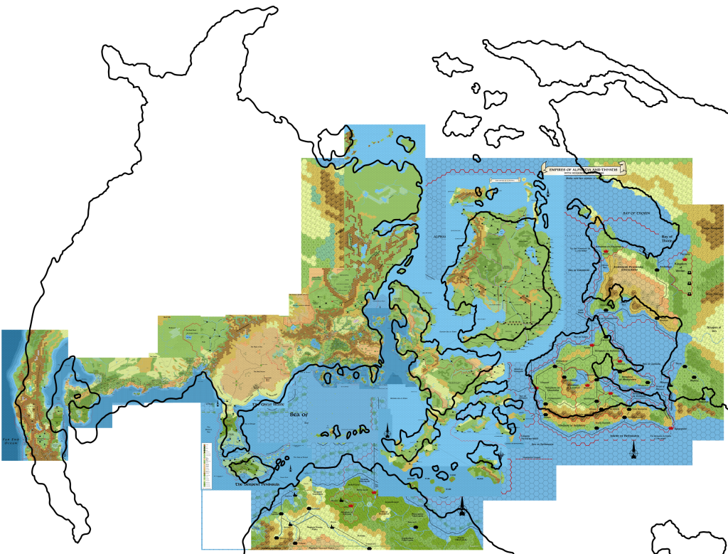
Note how this scaling fits the Known World, all the way up to Frosthaven in the far north of Norwold.
Now look at the Great Waste, the Serpent Peninsula, the Savage Coast, the Orc’s Head Peninsula, and the Arm of the Immortals. It seems that the maps in X4, X5, X6 and X9, upon which all of the later maps from the Great Waste to the Orc’s Head were based, angled the coast slightly differently from the world map’s version.
Could we make this fit better by applying a slight rotation?
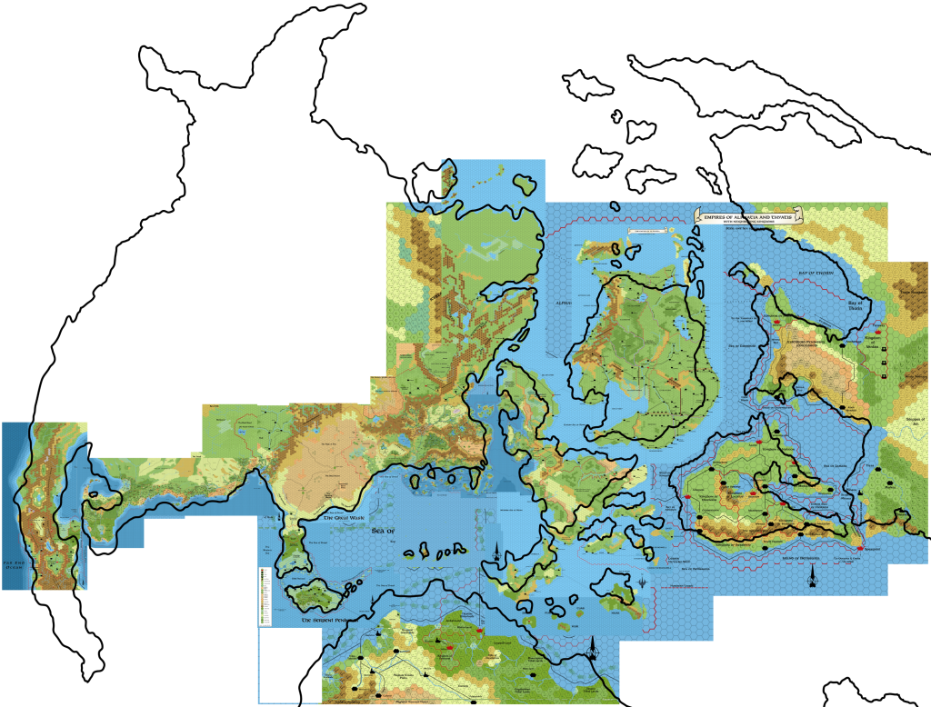
This seems to fit the Known World coastline and Norwold better. And we now have a reasonably tight fit from Frosthaven in the north all the way round to the Gulf of Hule, ignoring the slight bulge of the Northern Reaches.
Unfortunately, the Savage Coast area is better, but still not close enough.
There’s no way round this — there is simply no best fit for Brun’s continental outline. My solution is therefore to create two best fits, and merge them wherever seems to fit best — likely on the northwestern coast somewhere.
Before we get into that, take a quick look at the rest of the continents. Everything from the Isle of Dawn to Skothar and Davania seems pretty out, doesn’t it? And yet the scaling is not too bad — it’s the locations that are off. Because of this, I propose that we simply treat each landmass separately, or in logical groups, at least, and try to get the best fit for each. For most of the stuff in the Alphatian Sea region, it doesn’t really matter anyway, because we don’t need the world map to expand these areas. Where it starts to matter is in the parts shown only in white here, or on the periphery, as these are the regions for which the world map is the only source. Of course Skothar and Davania will need to be placed and fit with reference to the small areas of each appearing on the hex maps.
One thing’s for sure: it’s going to be messy, and quite arbitrary. You can see why I’ve been putting this off for so many years!
Back to Brun… Let’s get rid of the other landmasses for now. Here’s the best fit for the Savage Coast et al:
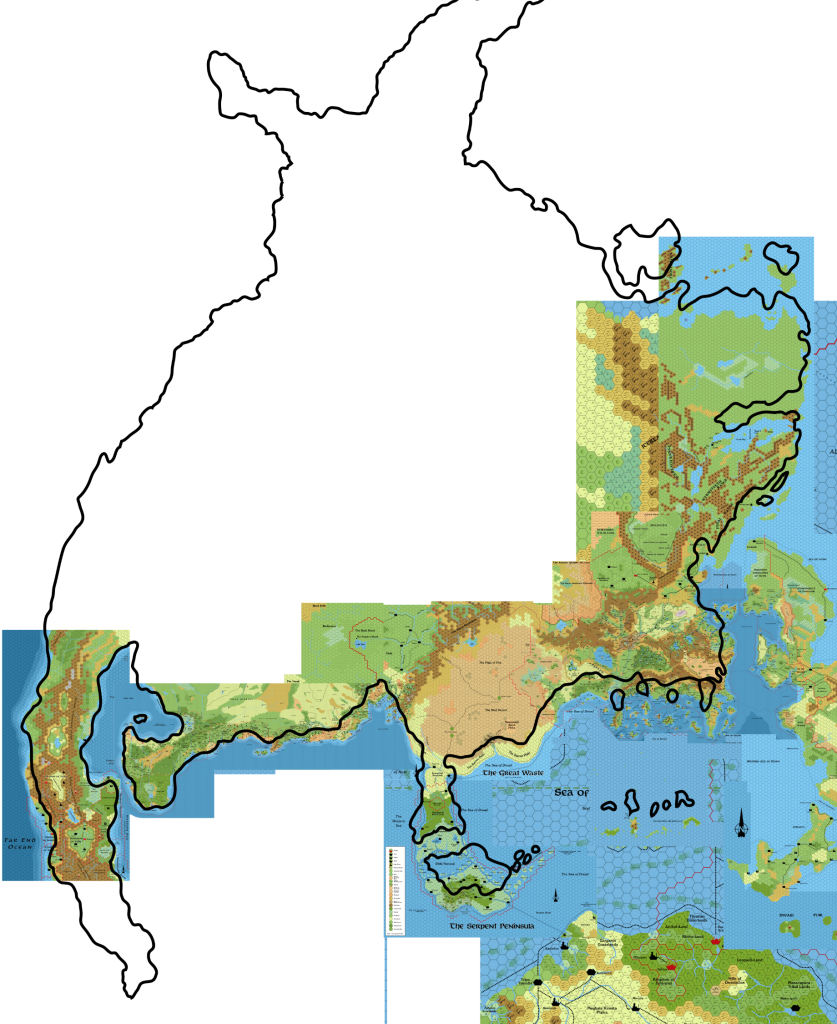
I’ve based this fit on the Orc’s Head Peninsula, and you can see it’s the same placement I used back in January to place and expand the Arm of the Immortals.
Let’s see how these two best fits look like together, with the Known World placement in black, Orc’s Head in red:
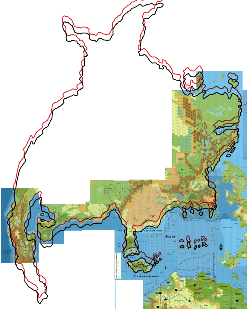
We want to change the northwestern coastline as little as possible, and it looks like there’s an easy point to merge them in the northwest of my Arm of the Immortals map. The whole coastline from the Orc’s Head Peninsula to northern Norwold will of course not be taken from this outline, so the fact that the Savage Coast doesn’t line up with either fit is not a problem.
Here’s a very basic preview of what this will look like:
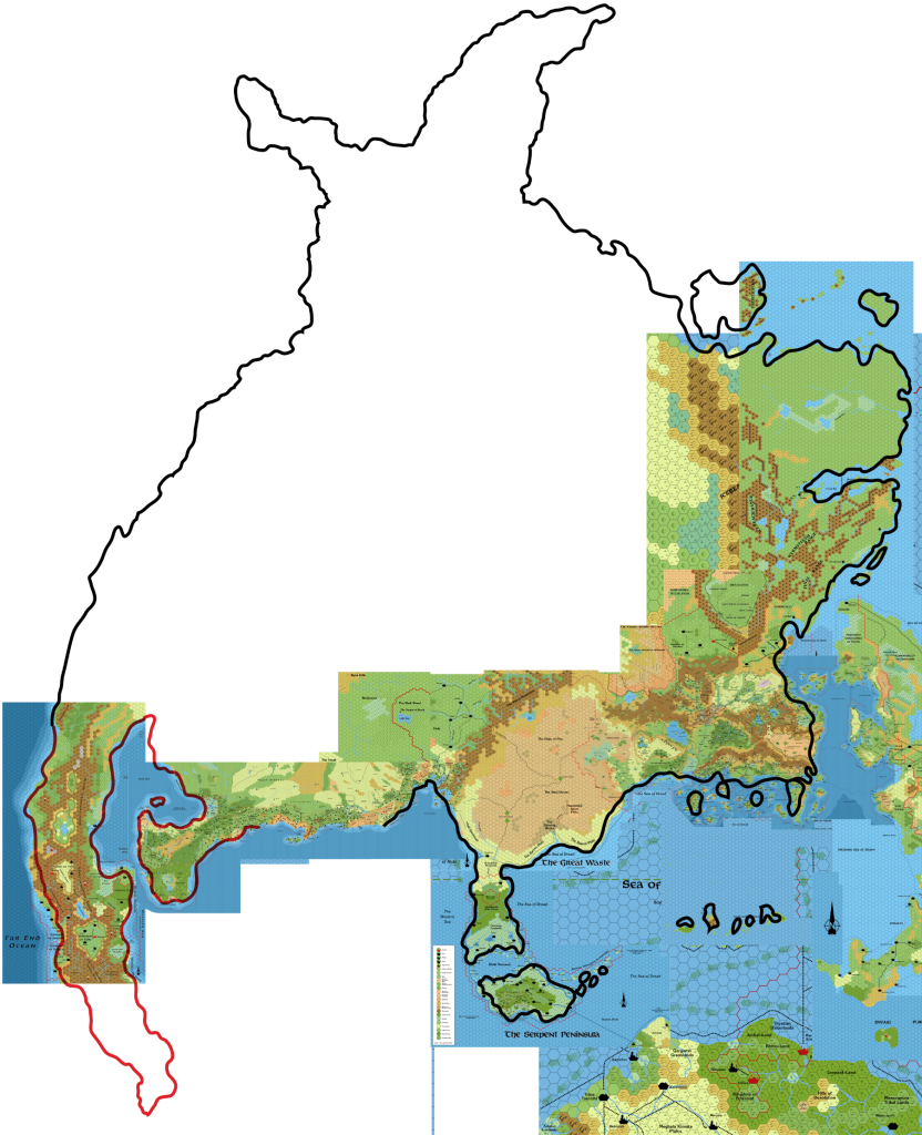
Looking pretty good!
For Brun, there is actually a more detailed coastline available from the Companion Set/CM1, but it should be quite easy to scale it to this model in the same way as I have done with the Master Set map here.
Rotation & Scaling
The next big question is whether to carry the rotation we applied to Brun to make it fit over to the other landmasses. Brun needed a 1.85º clockwise rotation to get a really good fit with most of its hex map representations. Does this mean we should apply the same rotation to the other continents and landmasses?
Similarly, my first instinct is to use the same scale for all of these landmasses now that we have Brun’s locked in. Is this correct? Or should be consider scaling each landmass separately?
Let’s take the Isle of Dawn and the isles south of it as a test case. With slight rescaling, we can get a near perfect fit for these using a 2.61º clockwise rotation:
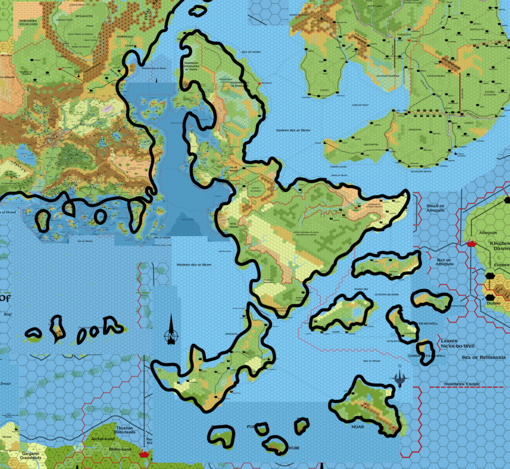
This is a pretty good fit. Clearly the coastal outlines were far more detailed on the hex maps, so we can’t expect perfection. But overall it looks pretty good.
That we had to rescale this is troubling. I’d prefer to keep the same scale throughout. Let’s look at the other areas before making a conclusion on this.
But adjusting the rotation for a best fit seems to definitely be on the table. This is a good situation, because I’d rather go with little or no rotation for the Master Set versions of Skothar and Davania if possible. Skothar is long, and rotating it even a little can drastically change the location of its far eastern “tail” and Zyxl.
Alphatia
This is a problematic one, because the world map depiction of Alphatia is very different from its hex map form:
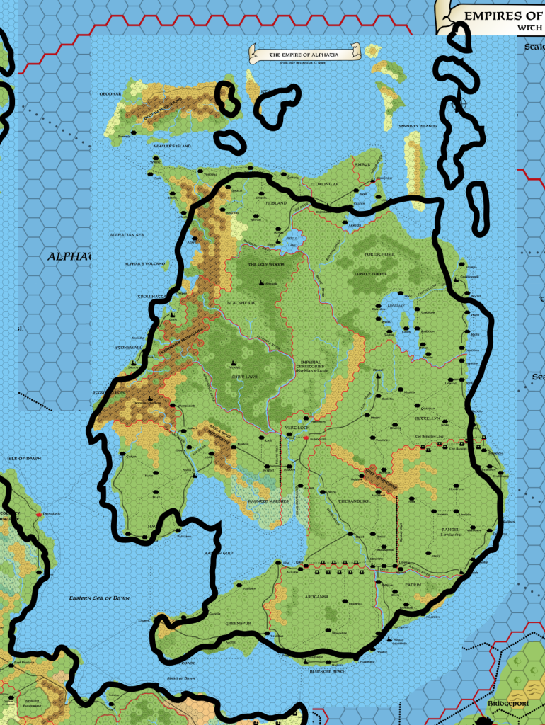
It’s hard to say what needs to be done here. So let’s just ignore it — we don’t need it, and it’s clearly no use as a reference. The islands north of it on the world map (not shown here) can be placed together with Skothar instead.
Bellissaria
How about Bellissaria? It’s a similar situation to the Isle of Dawn, fitting very well with slight upscaling. But it actually fits with its rotation the same as Brun:
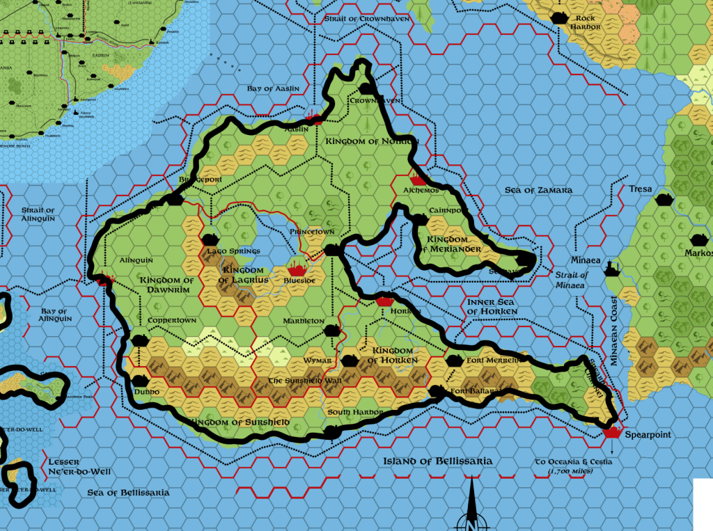
It seems, then, that we can adjust scaling and rotation, but it would be best to try to keep this to a minimum.
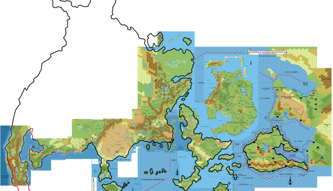
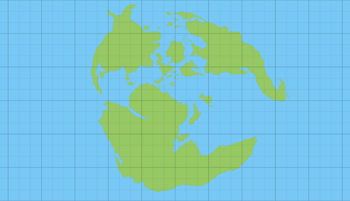
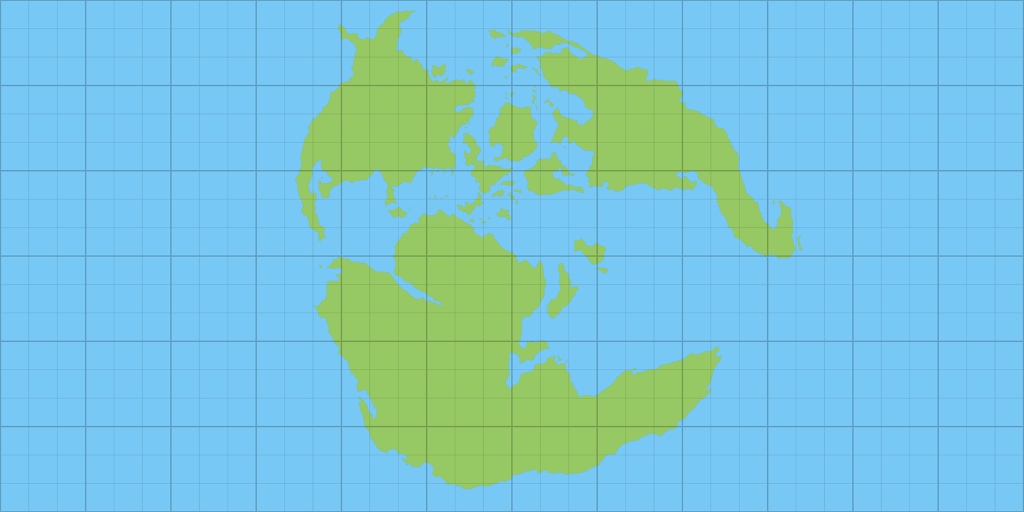
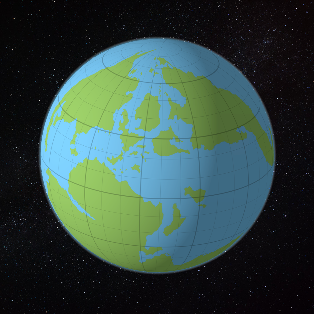
And that brings us to a close for today. I’ll leave you with our customary progress snapshot:
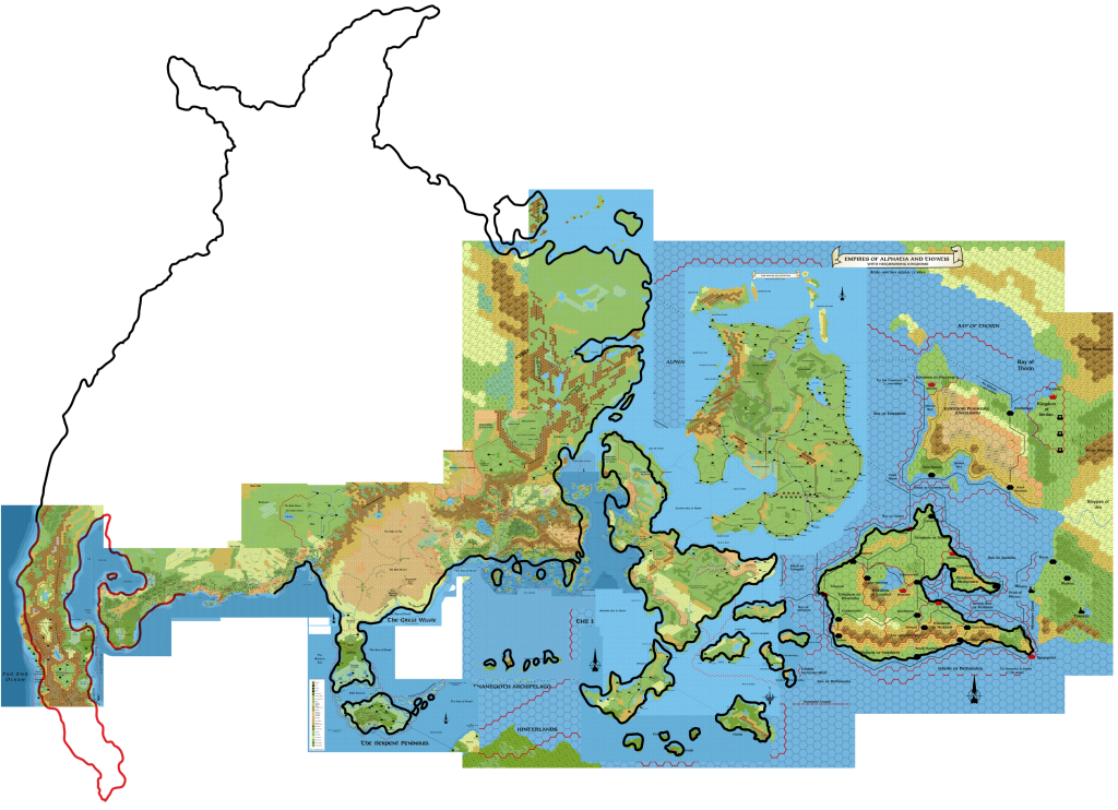
Next up: Skothar and Davania.
