Lining Up Mystara Revisited IV
It’s time to solve the problems I brought up in my second article, and then move forward with Solution 1 from last time.
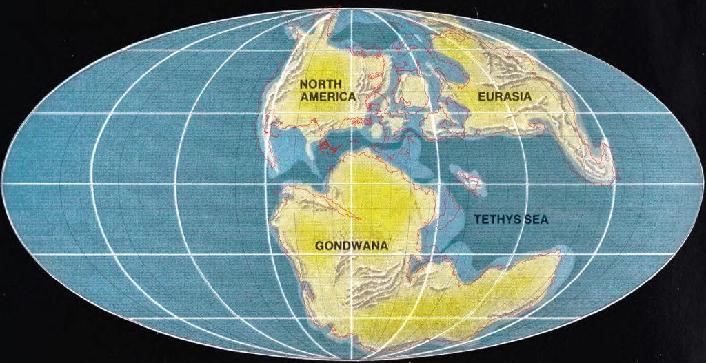
Lining Up Mystara with Jurassic Earth
After some discussion in the Mystara Cartographic Society on Facebook, I decided to keep my 2016 model’s hex map-based coastlines. The match with the Jurassic Earth map is really not tight enough to warrant changes. (Click here for the Facebook post if it is not appearing embedded below.)
At the same time, the consensus was that the 2.2º rotation of Brun to match CM1’s map with the Master Set outlines is a step too far, making life difficult for cartographers for minimal gain in accuracy.
To sum up:
- Coastlines derive from the Master Set map, except
- where there are official hex maps showing
- more precise relative locations
- more detail
- Brun, which is instead taken from CM1, rotation and all
- where there are official hex maps showing
- Placement is based on a best fit with the Jurassic Earth map
- It’s far from exact, but the Master Set map doesn’t fit much better
- Brun’s location slightly further north than on the Master Set map is not fixable without shifting or rescaling the Isle of Dawn
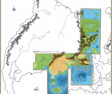
Here’s the final overlay that I’ve come up with:
Using this, I’ve now finished preliminary georeferencing of the three continental 72 mile per hex maps. It all looks great, and with minimal tweaks to get these already-in-progress maps to fit. The area of Hyborea sticking out from the map will be clipped when reprojecting, but that’s no problem — I’ll just redraw it inside the polar opening manually.
I’m quite happy with how this has worked out.
Exploring Solution 1
With georegistering completed, it’s now time to delve into the solutions I presented in my last article. Specifically, Solution 1 (accepting the map as is), which community feedback has confirmed is the most popular way forward.
It’s a question of size
The main problem to be solved with Solution 1 is the issue of size. This is an issue we previously dealt with in my last project, two years ago. The key problem is that Mystara’s hex-mapped area implies a rather large world.
Let’s walk through the problem. Once we’ve locked in the world map, we can measure the size of the world using latitude and/or longitude. It’s easy to measure 1 degree in hexes and calculate the size of the world from there: on a sphere, the circumference at the equator or round any line of longitude is regular, so multiply the result by 360 to get the whole world’s circumference.
As an aside, some of my fellow Mystara cartographers argue that 72 miles should be taken to equal 1 degree, as it allows easy calculation of latitudes simply by looking at the hex map. The problem with this is that official maps have far too many 72 mile hexes in the northern hemisphere for this to work.
I actually got very close to this in my 2016 model, which made the world a lot smaller (circumference 27,216 miles) by shunting the extreme parts of Brun, Skothar, and Davania past 90º. My focus was on getting the official latitudes to line up, so I actually used 10.5 72 mile hexes per 10 degrees rather than a clean 1 to 1.
In any case, this is not an option for the 2018 model, for reasons I’ve already stated: namely, moving landmasses around is something we don’t want to do, because it breaks the validity of the published hex maps while also warping the coastlines in strange ways.
So how big is the 2018 model?
I’m glad you asked!
The answer is not as simple as you might think: in fact, there are actually lots of choices here. Because Mollweide is an equal area projection, the hex scale is not consistent throughout the maps, so what we’ve been treating as 8, 24 and 72 mile hexes for all these years are actually not exactly those sizes. (The area of each hex is what is consistent throughout the map, not the distance or shape.)
Further, we can’t make all the hexes throughout the world conform to a constant scale, though for game use the difference can obviously be ignored.
This essentially leaves us with a choice: which part of the map do we want to have hexes closest to those sizes?
The answer is surely going to be the Known World.
I have therefore decided to measure 1º of latitude right next to Thyatis City. The result should be that the Known World and all similar latitudes have a hex scale almost exactly as we expect. Areas close to the equator will be 72+ miles per hex, while areas closer to the poles will be 72-.
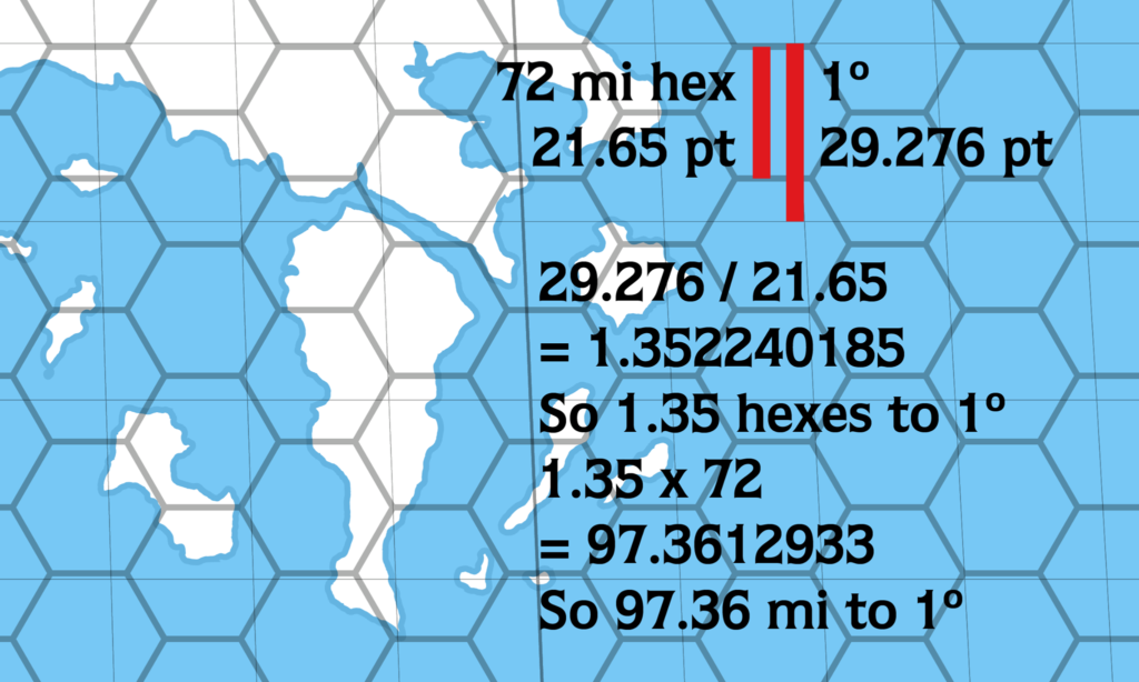
The “pt” unit here is “points”, which are Illustrator’s native units. It’s not really relevant here except as a ruler.
Let me walk you through it:
- We have the final world configuration, with the hex grid in place.
- I drew a line across a 72 mile hex.
- Next, I drew a line covering 1º at Thyatis City’s latitude.
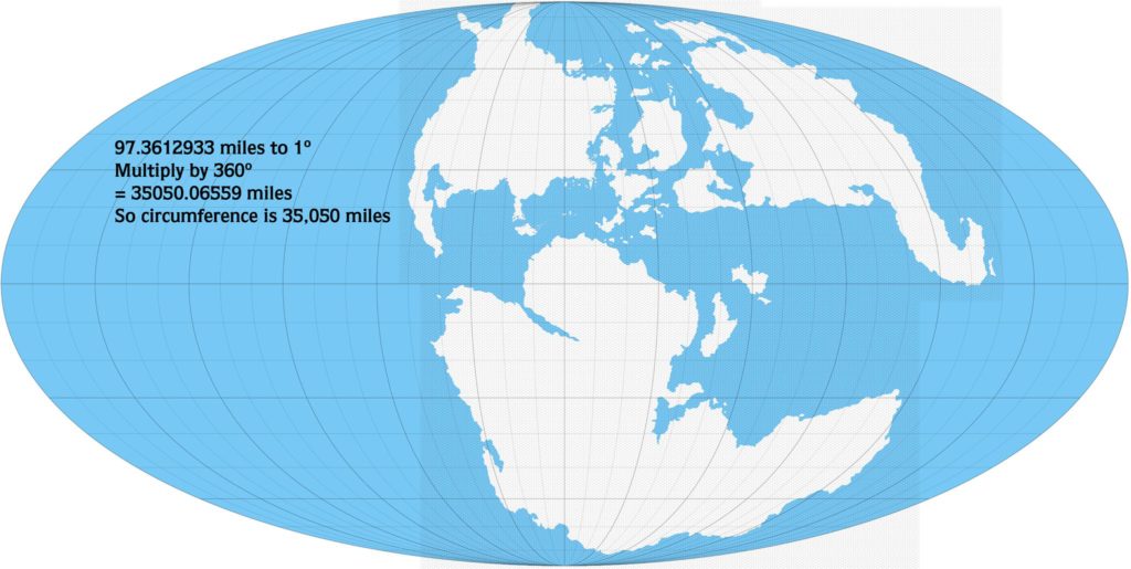
- The hex measured 21.65 points, while 1º was 29.276.
- Divide 1º by the hex’s measurement to see how many 72 mile hexes fit in 1º.
- The answer was 1.35 hexes to 1º.
- Multiply this by 72 miles to get the number of miles in 1º.
- The answer was 97.36, so 1º measures 97.36 miles.
Next, we can multiply this by 360 to get the world’s measurements.
As you can see, the result was 35,050 miles circumference.
(Incidentally, I also measured at the equator, just to see the difference. An equator-based circumference would result in a significantly larger world, with 101 miles per degree and over 36,000 miles circumference.)
So, 35,050 miles around the equator… Again, this brings us back to the size problem from two years ago, and a giant Mystara.
I brought this up in the Mystara Reborn Facebook group for feedback, and the general consensus was that big is better. So from a design standpoint, a larger Mystara doesn’t seem to have many detractors. (Click here for the Facebook post.)
Now for the nitty-gritty details.
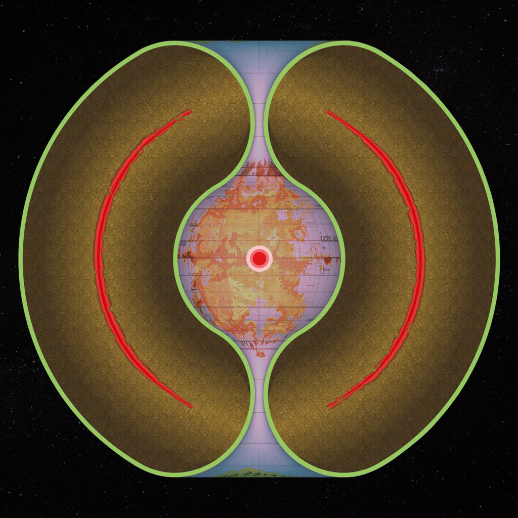
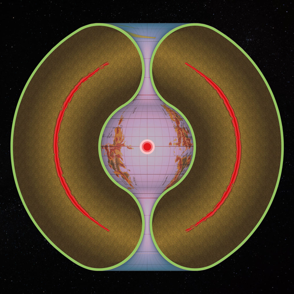
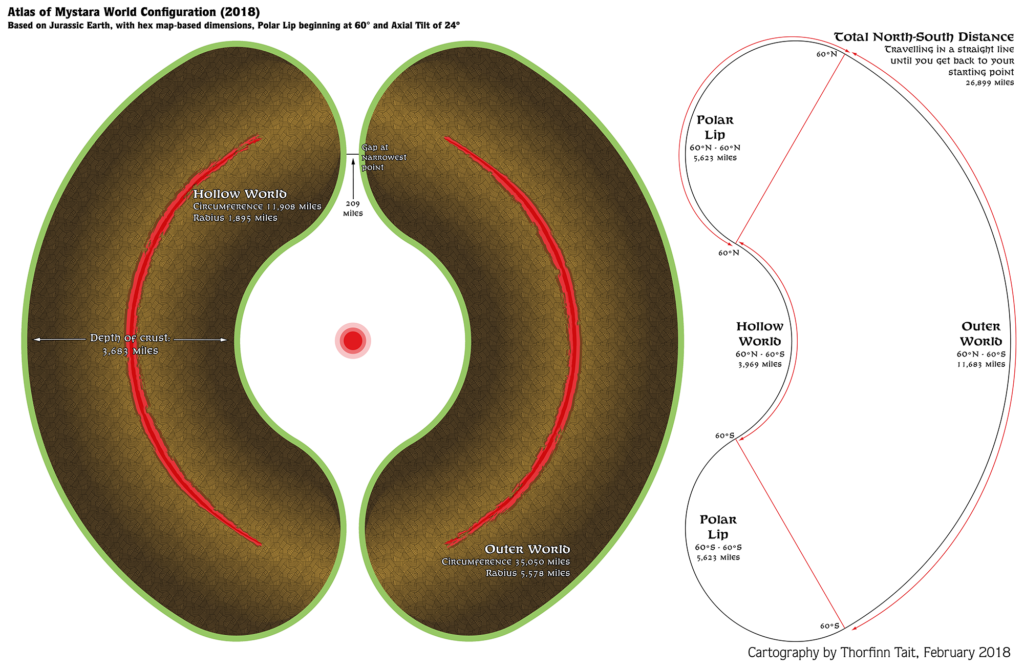
I can make this work through two compromises with the polar openings: lowering the starting latitude of the polar lip to 60º; and giving up on the perfect circle/regular torus design, instead using ovals to “cap” the two worlds at their join.
Such a low latitude for the polar lip was not possible in my 2016 model, because we were following officially stated latitudes, with Farend at 60º. But it actually works fine on the new 2018 model because Jurassic Mystara has Norwold and northern Alphatia further south. In fact, less land falls into the openings on this model, despite the lower starting latitude.
The squashing required to create a decent-sized opening is also not that much. Take a look at the diagram and see what you think.
You can see all of the major dimensions on this diagram, fully up to date with the results of my measurements above.
Wait a minute — what about those latitudes?
Don’t worry, I’m not forgetting about this.
To recap, the other major problem with using Jurassic Mystara is the latitudes, and specifically the climate. Latitudes do not match those given in TM1’s table of latitudes, or in the Poor Wizard’s Almanac series. This in itself is not really a problem, as it’s one official source versus another.
However, the climate repercussions are another matter entirely.
My solution for this is simply to assume that Mystara’s climate is cooler than the Earth’s. Really, we’ve been staring this one in the face for years, and the problem has only been exacerbated by Jurassic Mystara’s configuration — which is to say, it already existed even in the officially listed latitudes.
Official latitudes placed Thyatis at 30º, whereas my 2018 model has it 26 or 27º. This isn’t a huge difference.
So, we need to start remodelling our climate ideas with a generally cooler world in mind.
I think that’s all the loose ends tied up as well as we can manage for now.
The Atlas of Mystara 2018 model
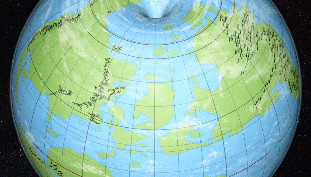
Seeing is believing. Let’s take it for a test drive and see how it performs!
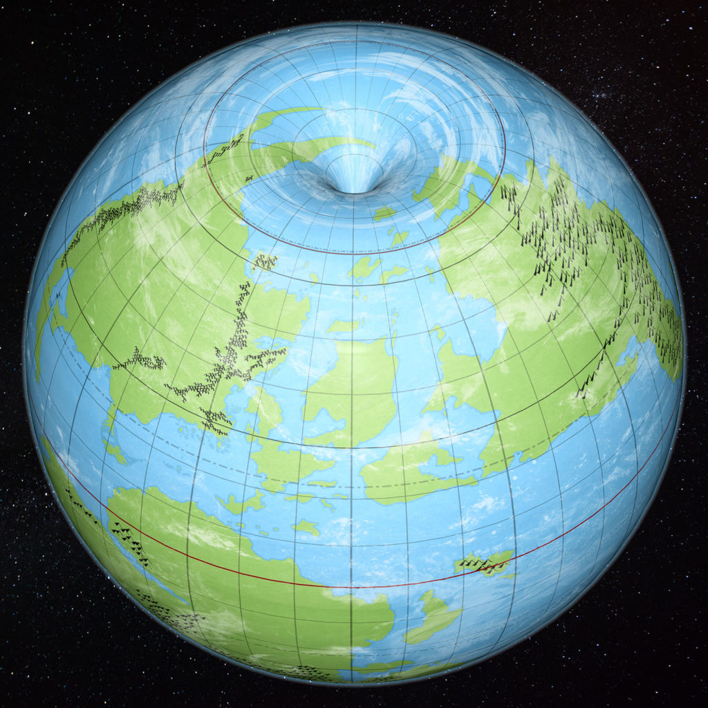
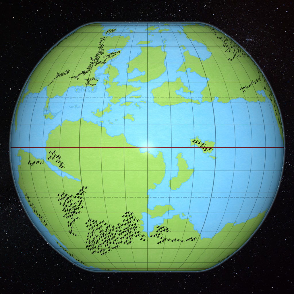
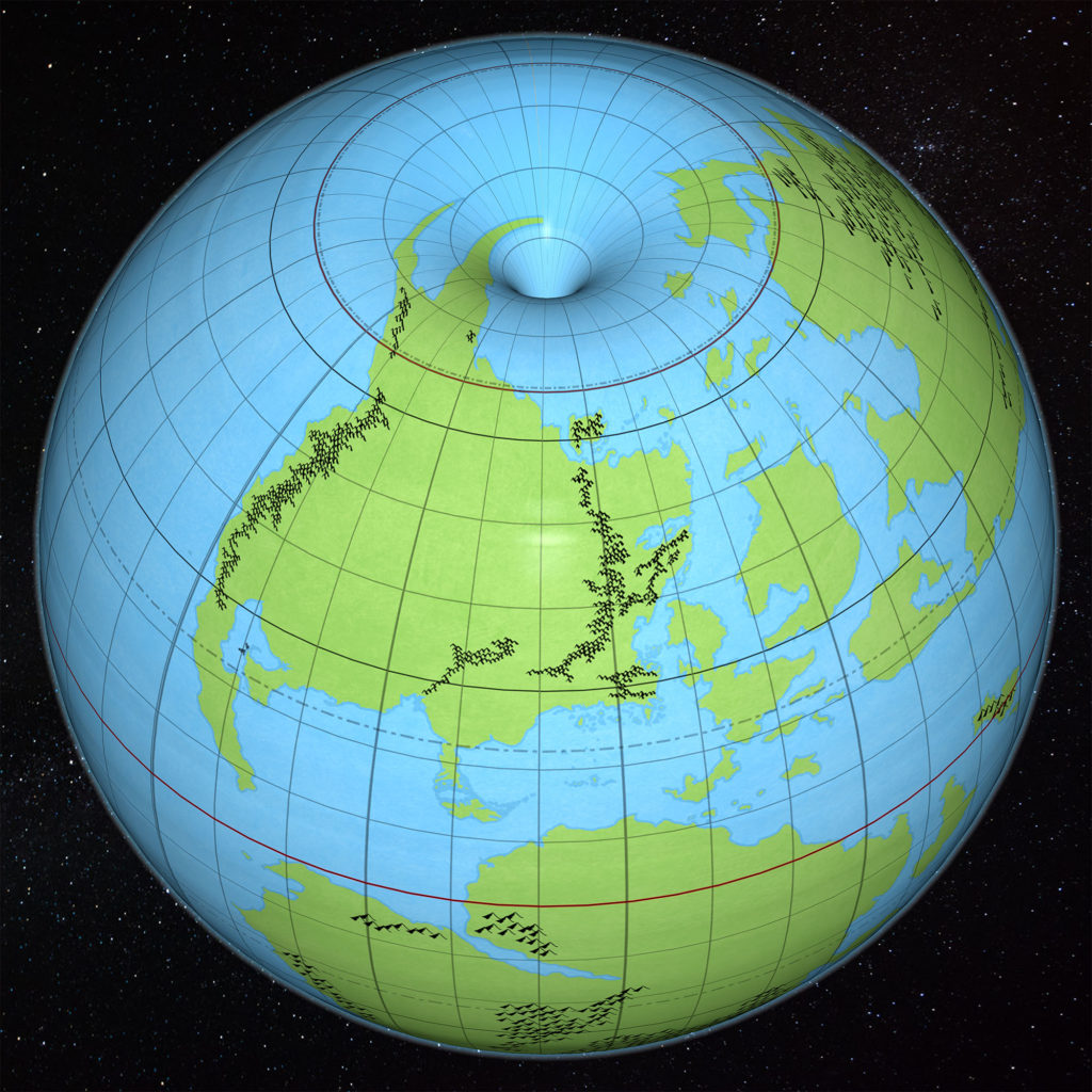
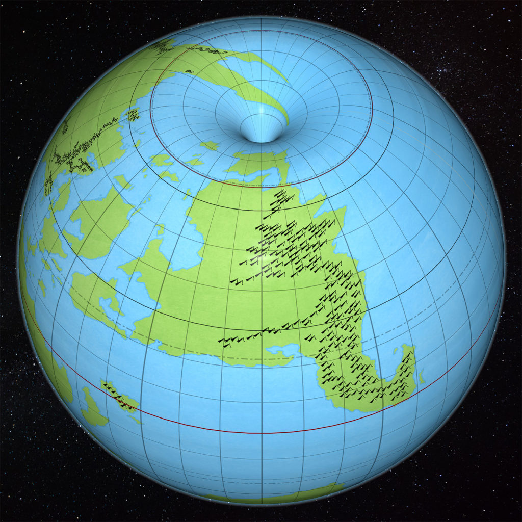
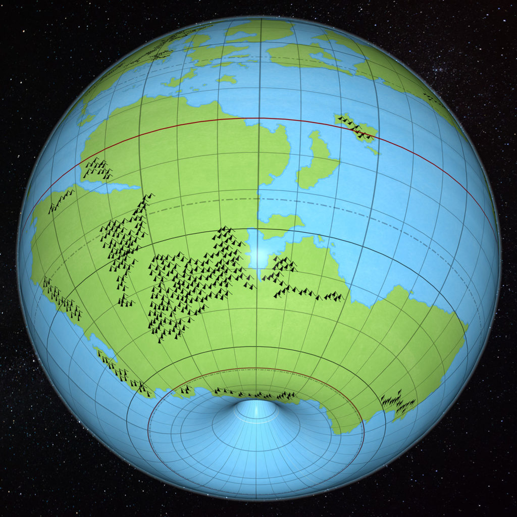
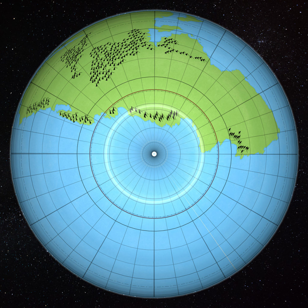
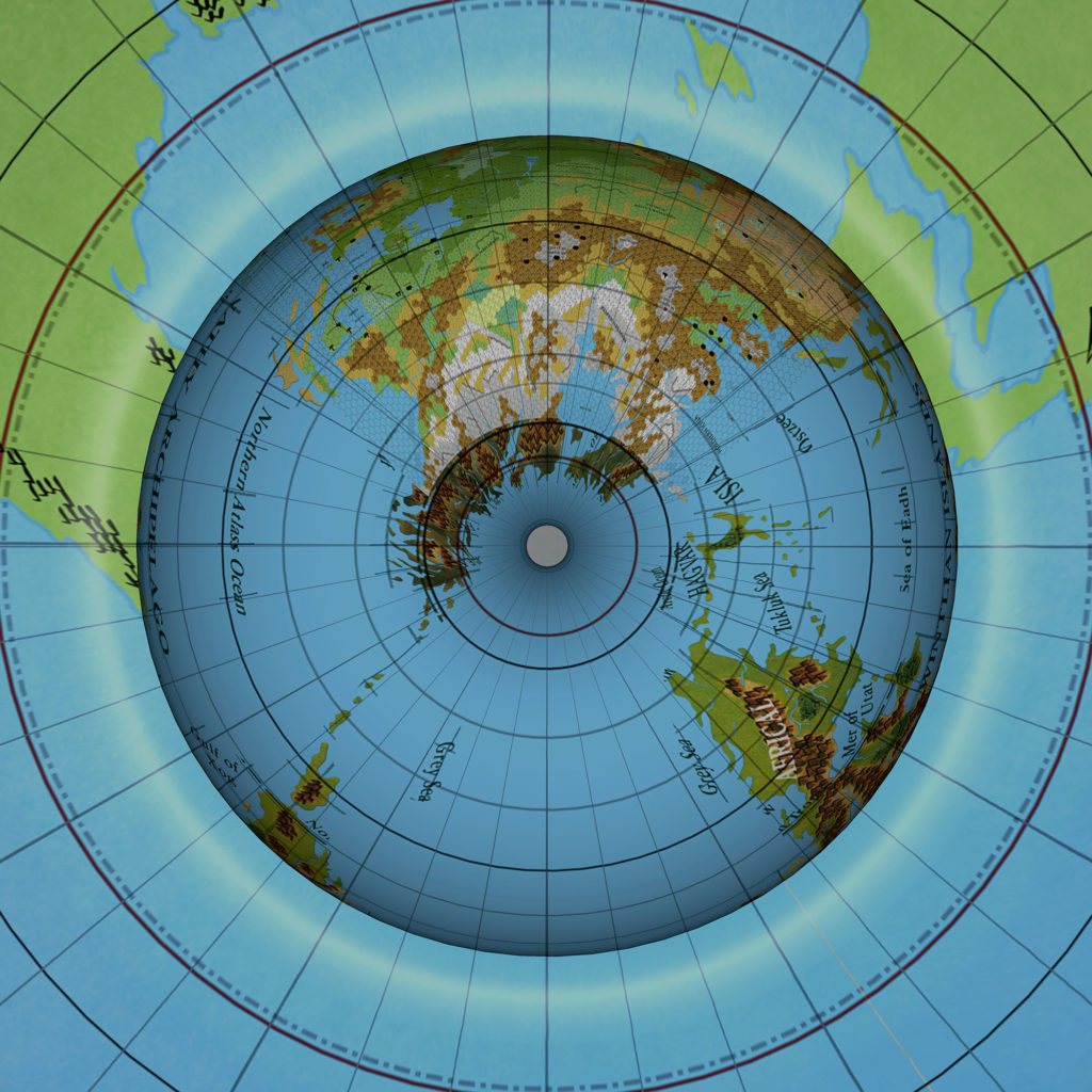
So, what do you think?
I’d love to hear your thoughts about this new model, and work through any issues that are brought up before finalising it.
If nothing else needs tweaking, I will go ahead and lock in the size with a new set of geodetic coordinates and a new ellipsoid, allowing me to finalise georeferencing — not only of the world map, but in fact of all the hex maps.
I will also get back to finishing the 72 mile per hex maps of Brun, Skothar, and Davania, which are now fully georegistered, and ready to use Jurassic Earth information to draw in the continental shelves and shape the mountain ranges.
Then there are world maps to redo, and the climate map to revise and finish.
2018 is certainly shaping up to be interesting times for Mystara!
23 February 2018 @ 11:59 pm
It looks fantastic! Personally, I’d be fine with this map, even though the polar openings seem to go into the Hollow World a bit weirdly (or maybe I just hadn’t pictured them in my head) but I can see how that must be one of the trickiest parts to tweak withouth stretching the map in odd ways. Great job!
24 February 2018 @ 12:09 am
When can we buy a globe for the library?? 🙂
24 February 2018 @ 1:55 am
Congratulations, Thorf: a great work and, in my opinion, a very satisfying result. Brun and Davania, but even Skothar’s northern parts, turn out very well on the globe. There are still some things which I find difficult to adapt to – namely latitudes and the larger planet – but after all we have to make choices and to settle some sort of compromise, and since preserving the hex maps was deemed the priority, the rest came as a consequence.
New latitudes are the most thorny issue. Re-adapting Mystara climate to them is undoubtly the best choice, since things like Frosthaven below the Arctic Circle, or the Great Bay of Norwold (which should freeze in coldest winters) and Qeodhar approximately found at Paris’ and London’s latitude are hard to digest. To preserve canon description of some northern regions then Mystara has to have a colder climate, globally. I’m far from having any particular knowledge of glacial periods and variations like Mylankovitch cycles, but I wonder if the colder climate could be explained by things like that.
I’m lookiing forward to further developments of the 2018 model, and especially to the 72mph maps of the continents!
P.S.: Don’t forget to add the missing islands of the (Eastern) Thanegioth Archipelago to the map. 😉
1 March 2018 @ 7:21 am
@Simone Neri: Remember that Paris is at a latitude north of most of the Continental United States, in fact, north of Quebec City and Montreal areas that get bitter cold winters. Europe is warmed by the Gulf Stream and the North Atlantic Current, without them the weather in London and Paris would be far colder. As Mystara was developed by a North American company, it follows they would use temperature profiles that match North America and not Europe.