Lining Up Mystara XV
Hollow World Set Maps Revisited I
Before we continue with the 3D model and choosing a placement, I think it’s time to take a closer look at the Hollow World Set world maps. This treatment is going to get long and complicated, so I’m going to split it up and present it over the next few days.
The Hollow World Set came with world maps for both worlds, inner and outer, in a pseudo-Robinson projection. I’ve already mentioned the problems with the Outer World map, but it’s worth going over them again now.
Hollow World Set Outer World map

The world maps in this set were full of detail, in terms of both place names and overall terrain, making them invaluable sources for expanding the hex maps.
The main problem with this map is that it stretched the Master Set map’s coastlines out in order to fill up the pseudo-Robinson projection grid. In so doing, it broke the connection with the hex maps, which of course remained unstretched (since they were based on the Master Set map). This was all done by hand, of course, and it turns out they did a really excellent job of it, as we’ll see in a moment.
But before we can compare these maps, there’s something we need to do: we need to return the map to a standard latitude/longitude grid, aka an Equirectangular or Plate Carrée projection. (This seems like the most likely projection to assume for the Master Set map and the hex maps, because it’s just a regular grid, with all the cardinal directions where they should be.) I actually did this some years ago.
I used a GIS program called Manifold to do this. First, I added extra latitude and longitude lines to the map, so that it had a line for every 10º. Then, I painstakingly added a control point to every single intersection:
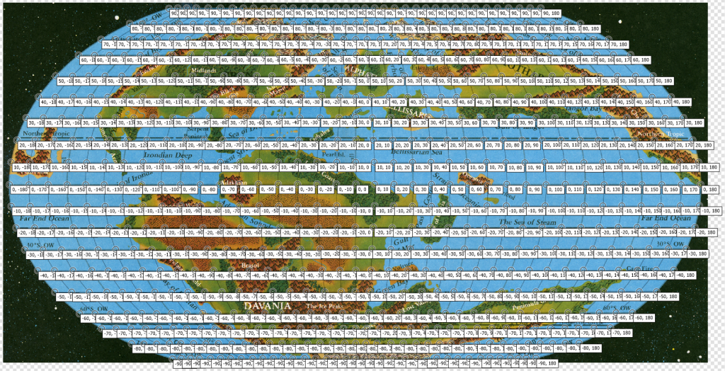
703 points in total — it’s not a terribly fun job… But when it’s done, you can then georegister the image and change the projection, pulling the pixels into new patterns based on the control points.
Here’s the result of changing it to Equirectangular projection:
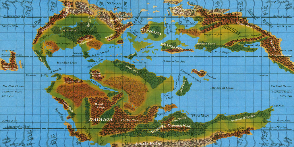
This is the projection needed to drape the map on a 3D sphere. It must be in a 2:1 ratio, or it will not cover the whole sphere. That’s essentially the problem the designers were facing when they decided to stretch the coastlines. (And in Mystara’s case, the polar openings mean that a 2:0.9 or 2:0.8 ratio is needed to cover the regular spheroid/ellipsoid areas of the planet’s surfaces.)
Now compare this with the full extent of hex maps we’ve assembled so far, and the stretching should be quite obvious:
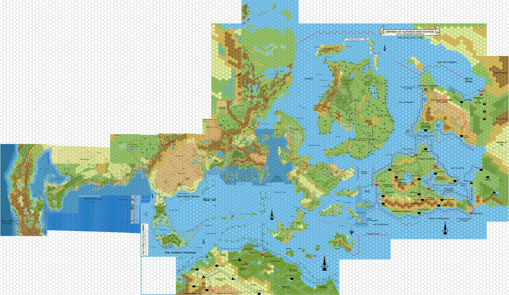
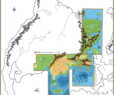
Here’s what happens when we overlay this:
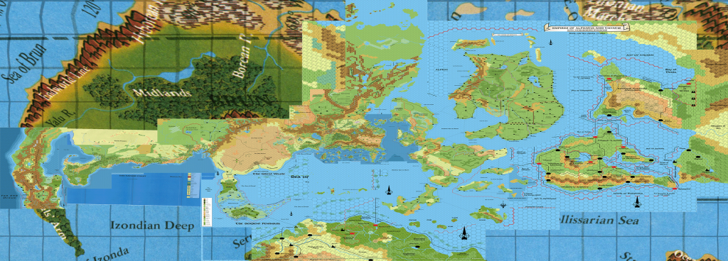
Note the stretching of the hexes east-west, or the north-south squashing if you prefer. The hex maps would need to be changed quite drastically to fit.
Also note, however, that the fit is actually pretty good. Let’s squash the map and overlay it with Master Set coastlines to see just how good a fit it is:
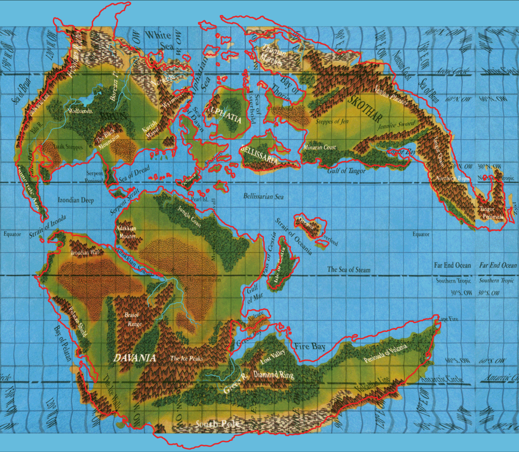
I’d say that’s pretty amazing for a reprojection done completely by hand. Once again, awesome respect for the original artists who did the cartography on these maps!
Now let’s do some analysis. I’ll try and keep it short and sweet.
- The Outer World latitudes were squashed to fit the projection template, but the land itself is mostly compatible with the Master Set version.
- The regions from 60-90º especially were shown smaller than the rest of the map. This was likely done to represent the approach to the polar openings, but the precise configuration remains vague. Notably, the land shapes are not different from the Master Set — they haven’t been squashed or stretched.
- The regions that were cut off past 90º were placed in the polar openings on the polar opening maps in the Hollow World Set.
- However, the latitudes on this map will not fit with our model, as shown in my exploration of Placements 1-3. They are also quite radical, placing Alpha at about 63ºN, which I think most will agree is too far north.
- The longitudes can all be safely ignored too, due to squashing.
- We can cut this map up in this squashed state and use it as a source to expand the hex maps.
That’s about it, I think.
Next: the Hollow World…
24 February 2016 @ 12:49 am
Thanks so much for this – I knew there were issues with the HW set projections, but great to see these images showing how it all works out (or doesn’t).
I guess the maps might still be helpful for giving some idea of how much of the outer world wraps round into the hollow world?
24 February 2016 @ 10:31 am
Yes indeed — although even better for that are the polar maps from the Hollow World Set. Even those aren’t conclusive, since the notation of latitudes is a bit vague.
24 February 2016 @ 1:09 am
Another great piece! I love the fact that the HW boxed set Outer World map can still be used as a resource in this fashion. Keep it up Thorf-meister! 🙂
24 February 2016 @ 10:32 am
Me too! That map is the best source for terrain for much of the world, so it’s great that it’s so easily usable.
24 February 2016 @ 2:15 am
Great work as always sir Tait.
The hollow world fitment is very impressive.
A bit off topic but looking at the full map reminds me of a conversation I had with my first DM over 25 years ago. He explained to me how the world of Mystara was based on the continents of earth sometime in the far distant past (supposedly).
In the full world map above, it does kind of look like Africa in the middle and North and South America to the left with a mash up Europe/Asia to the North and a mash up of Australia/Antarctica to the South.
Has anyone ever heard this story before?
Does anyone know if there is any truth to the myth?
I can not contact my old DM to find out where he got the information from. He was a freakishly talented and knowledgable DM back in the day.
24 February 2016 @ 10:41 am
Yes, this is absolutely true. You can see for yourself by looking at maps made by geologists to show what the world may have looked like back then. Try this one, for example:
https://www2.nau.edu/rcb7/170Marect.jpg
Or this one, which marks present-day political locations on the ancient map:
http://www.scotese.com/late1.htm
These don’t look identical to Mystara, but I remember seeing one in a book in the late 80s that was much closer. I think the configuration the continents are thought to have been in has evolved over the years.
24 February 2016 @ 1:29 pm
Ahh yes, Jurassic earth. It is a better fit then I thought. The Serpent Peninsula was Florida! Ah I found one of Bruce Herd’s blog posts on the climate of Alphatia where he uses the Jurassic map to work out the Ocean Currents. Thanks for the confirmation Thorfin.
http://bruce-heard.blogspot.com.au/2012/12/Climate.html