Mystara Climate Maps II
My Lining Up Mystara Revisited project is proceeding apace. I’m still working on the next post, but in the meantime I want to show you some of my progress, and ask for some feedback.
Work is continuing on continental hex maps for Davania, Skothar, and Brun, as well as the Hollow World. So I think that it’s about time we revisited the climate map and finished it off.
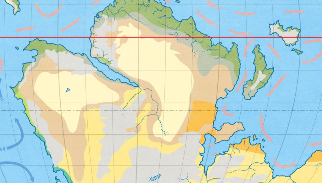
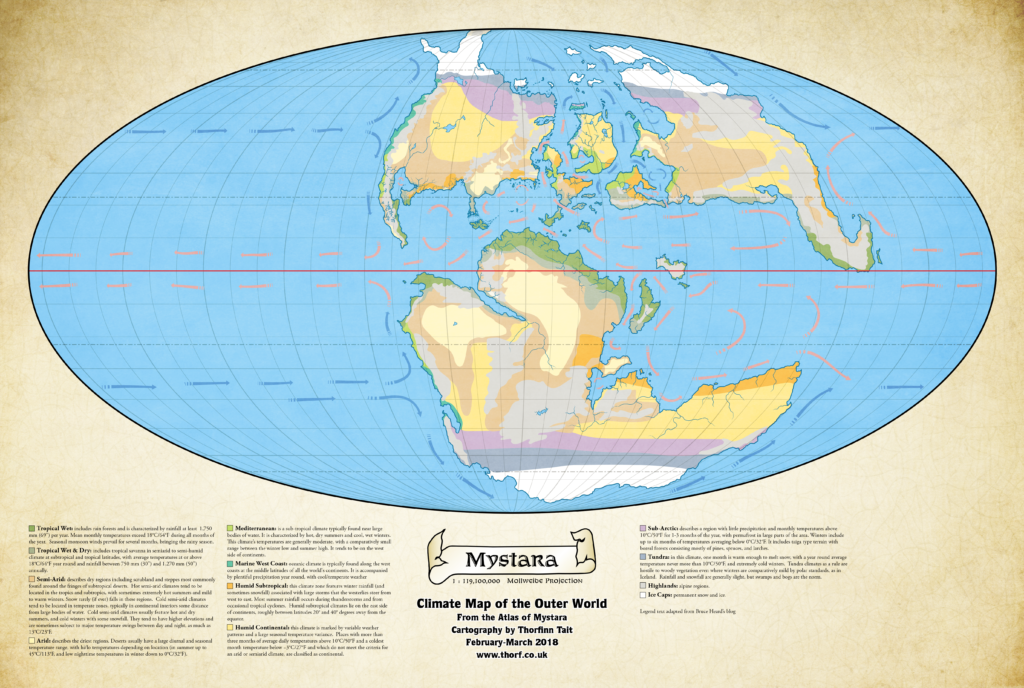
So here it is: the first (almost) complete version, in all its chaotic glory.
I’m quite sure that there’s all sorts of weirdness going on here, so please do leave a comment if you have any suggestions.
Part of the strangeness is due to the latitudes, which are a bit different from how we thought. Another aspect is the fact that a lot of terrain is already set, so for example Jurassic Earth climate maps are of very little use, as they tend to put everything in the wrong place.
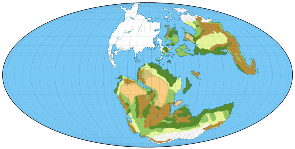
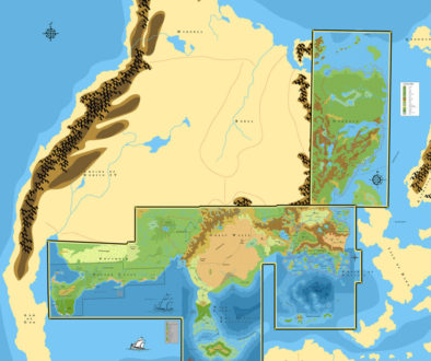
Here’s a quick and dirty terrain overview to go with the climate map. The colours are based on hex art, with the darker green representing forests. Everything else should be pretty self-explanatory. (Note that I’ve concentrated on Skothar and Davania, since Bruce already completed Brun for us.)
Skothar especially is very rough. The terrain is largely based on the Hollow World Set world map.
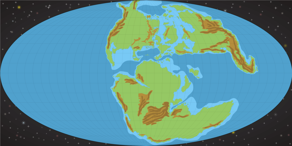
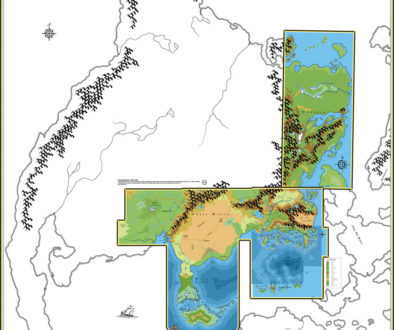
I’ll also share with you something rather nice that I’ve been working on: mountain ridges and continental shelves derived from the Jurassic Earth map.
I haven’t yet reconciled any of this with the existing maps, so some of it will surely not be any use. The Sea of Dread in particular is already detailed, so of course I’ll be bringing in the officially marked ocean depths to overwrite what’s in this image. Still, we now have something to base ocean depths on across the whole world, which is great.
That’s all for me tonight.
6 March 2018 @ 1:18 am
Very cool! (No pun intended.)
Skothar, 72 miles per hex | Atlas of Mystara
21 June 2019 @ 7:58 pm
[…] Climate Map of the Outer World, by Thorfinn Tait (2018) […]