Let’s Map Mystara 1983
In which we move through the world’s first mega expansion: 1983. Stay with me, it’s going to be a long post!
Mystara Geographic Maps 1981-1983
I’m afraid I still haven’t tackled B3 yet, but it’ll have to wait for another post.

In which we move through the world’s first mega expansion: 1983. Stay with me, it’s going to be a long post!
I’m afraid I still haven’t tackled B3 yet, but it’ll have to wait for another post.
It’s been a while since I’ve written a post for this project, but that’s not from lack of progress or activity — quite the opposite. In fact I’ve been repeatedly amending and revising a post for over a month now. Now it’s finally ready to share.
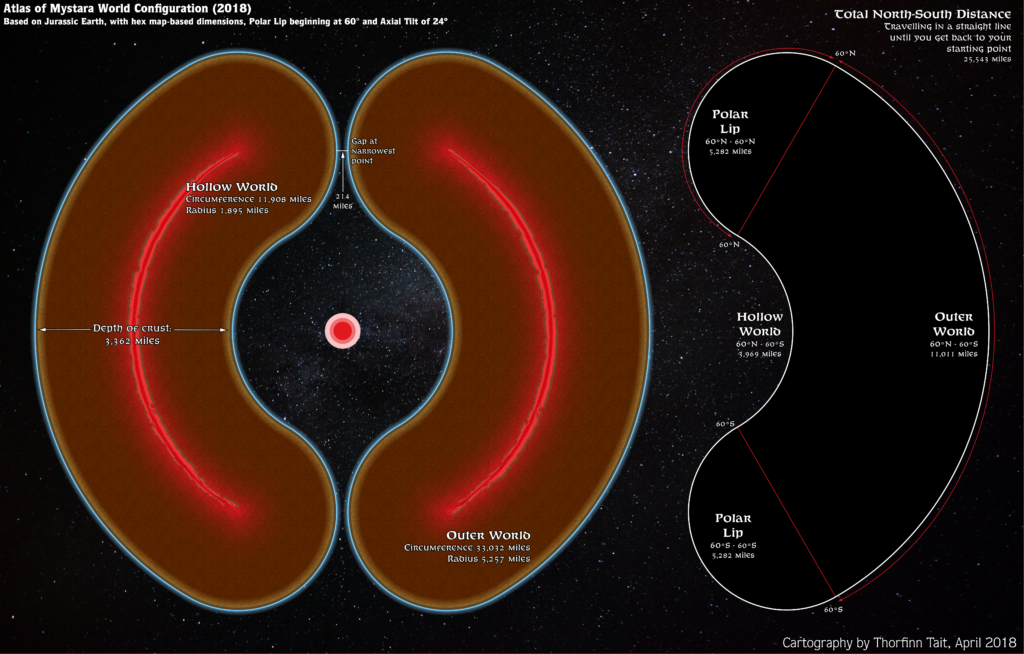
After the last article, I discovered that my calculations were a bit off. I’m not exactly sure why this is. I posted about this in the Facebook Mystara Cartographic Society (embedded below, if it’s working), and after discussions there (check the “Is my maths off in some way?” comment thread for details) decided to go with a round 36,000 miles for the circumference — primarily because chasing an exact 72 miles per hex was not working, and because this figure gives an easy 100 miles per degree.
Unfortunately, this didn’t work out either — it ended up giving far bigger hexes than I had expected, with 24 mile hexes coming out at 26 miles.
So I left it for a month or so. And then it hit me: I can reverse-engineer the circumference from measurements in Illustrator.
Basically, what I did was measure a hex, then divide the circumference by that number. Then I multiplied that by the desired hex size, which gave the actual circumference I needed to define the ellipsoid.
It turns out that Atlas Mystara has a circumference of 33,032 miles, which is quite a bit smaller than previous estimates. But this indeed made the measurements for hexes come out nearly perfectly in Illustrator, so I’m locking this in as our final circumference for the new 2018 model.
Phew! Now I just have to go back and re-georegister all those maps. Thankfully I already know how to do this without losing all the GIS data I’ve been inputting, and it’s not very hard.
As a consequence of all this, I have had to rebuild the model yet again — hopefully for the last time!
Oops… Looks like I spoke too soon…
In which we proceed through the rest of 1981’s maps and add 1982’s sole contribution.
From the Atlas of Mystara:
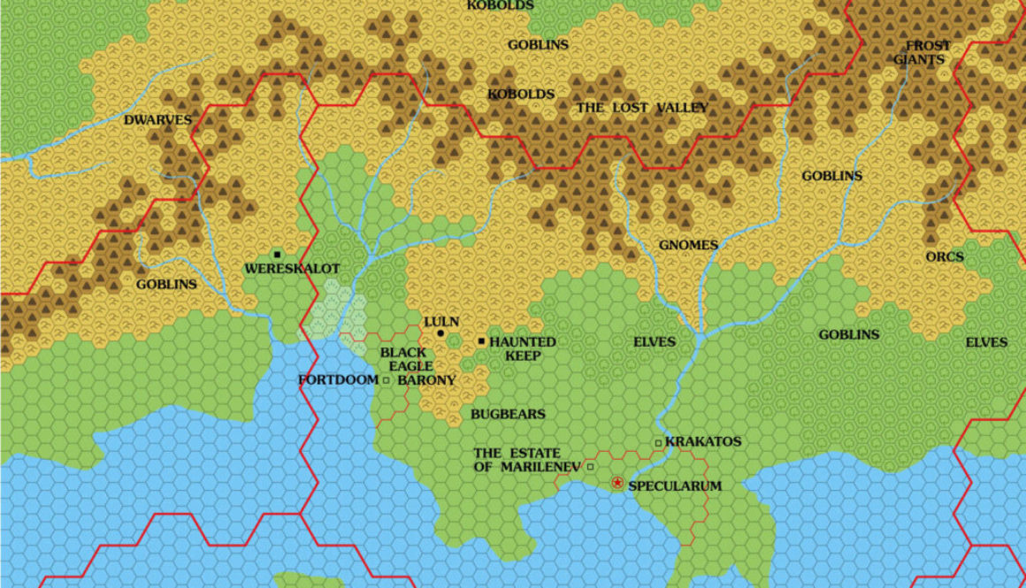
Although the 1981 Expert Set did not reprint the Known World map in any form, it did include a 6 mile per hex map of the Karameikos region. In addition to X1 (1981)’s cities of Specularum and Selenica, this larger scale map introduced a number of new settlements to Karameikos, including Luln (marked as a town); the Haunted Keep and Wereskalot in the neighbouring Five Shires (both ruins); and Fortdoom, Krakatos, and the Estate of Marilenev (all castles). The Black Eagle Barony is named, and labels appear for gnomes, elves, dwarves, kobolds, goblins, orcs, bugbears, and frost giants.
Interestingly, the Lost Valley is shown (though hard to make out) and labelled — and it’s across the border, in Darokin.
The text on page X60 provides some level of detail for some of these names, as well as a few more labels to add to the map: Gulf of Halag and Black Peaks/Cruth Mountains/The Steach.
The text also sets up the Black Eagle Barony and defines its relationship with Luln, and notes that the Haunted Keep is also known as Koriszegy Keep. Amusingly, half of the page is given over to the gnomes, although there is no mention yet of the name of their settlement.